Day 9 of the Colorado Trail

July 29

20.9 miles

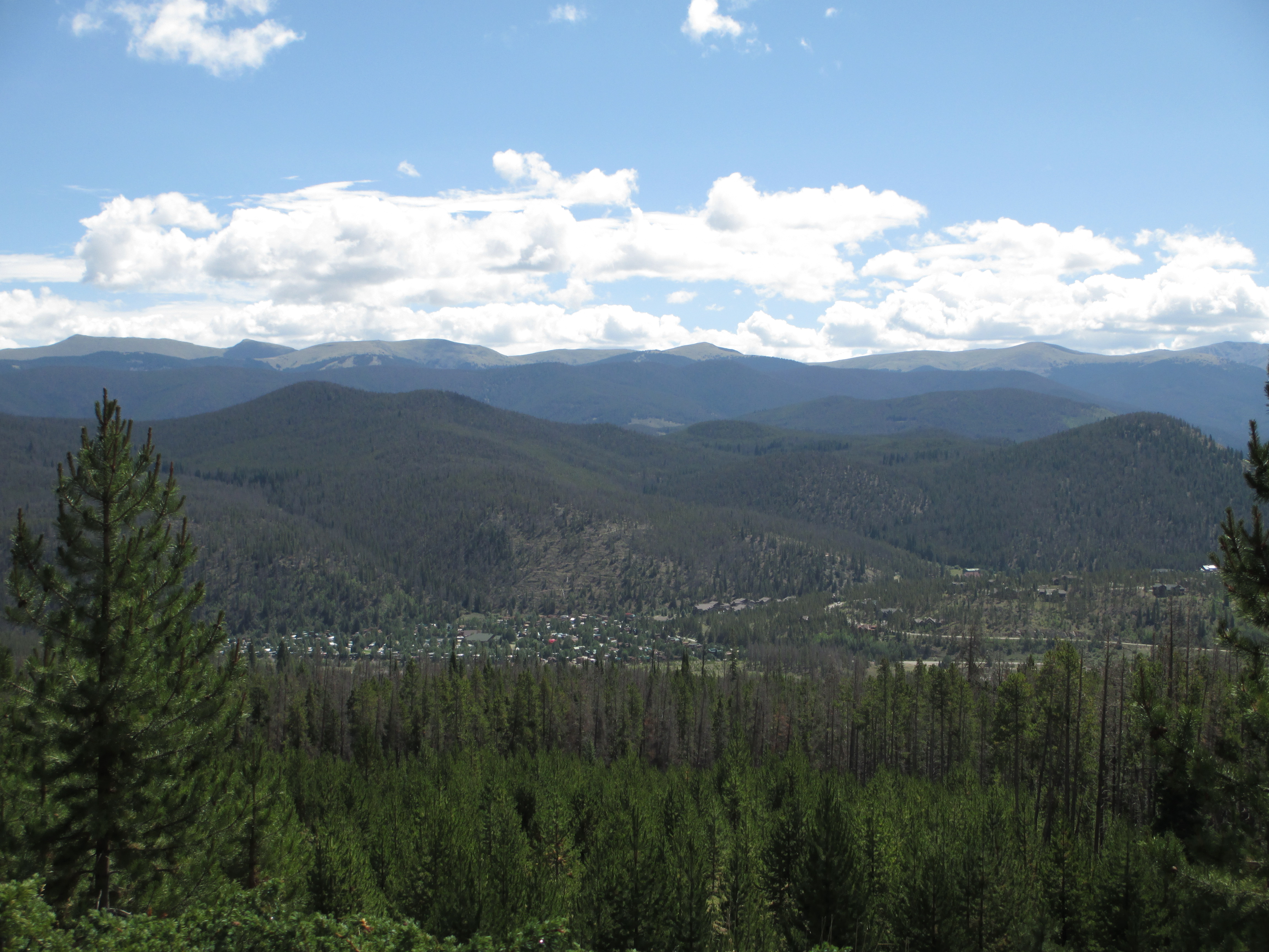
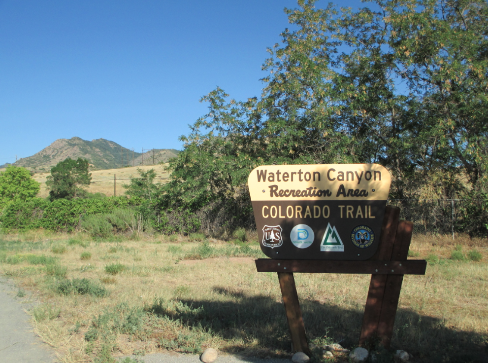
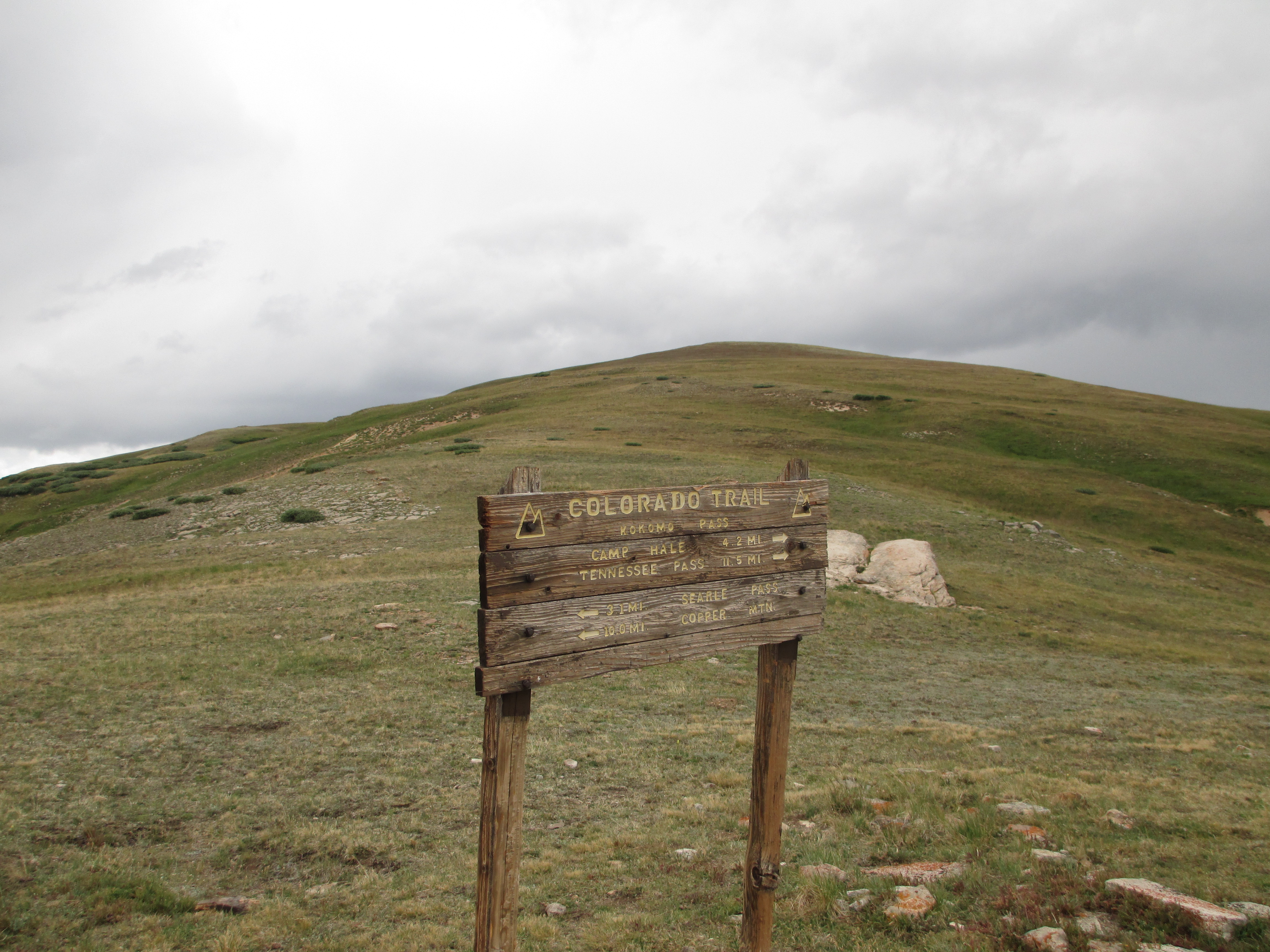
I got up around 6, hit the trail just before 7, hiked down to the highway, crossed the highway, went up a grass embankment, and then… had no idea where to pick up the trail again! My guidebook said the trail skirted a golf course before heading back into the forest, and that it was well-marked. I looked over the landscape, deliberating about which direction to take. I was very confused! I was supposed to pass under some ski lifts at mile 1.6, saw some across the golf course, and thought about cutting across. Instead, I wound up lost in some uphill putting sections! Ugh! Time was passing and I was going absolutely nowhere! I backtracked and came out to field level again, luckily seeing a post with a CT sign from a distance! Finally, I found the trail into the forest, ascended the switchbacks, and eventually passed under a series of chairlifts.
IMG_0352IMG_0353 
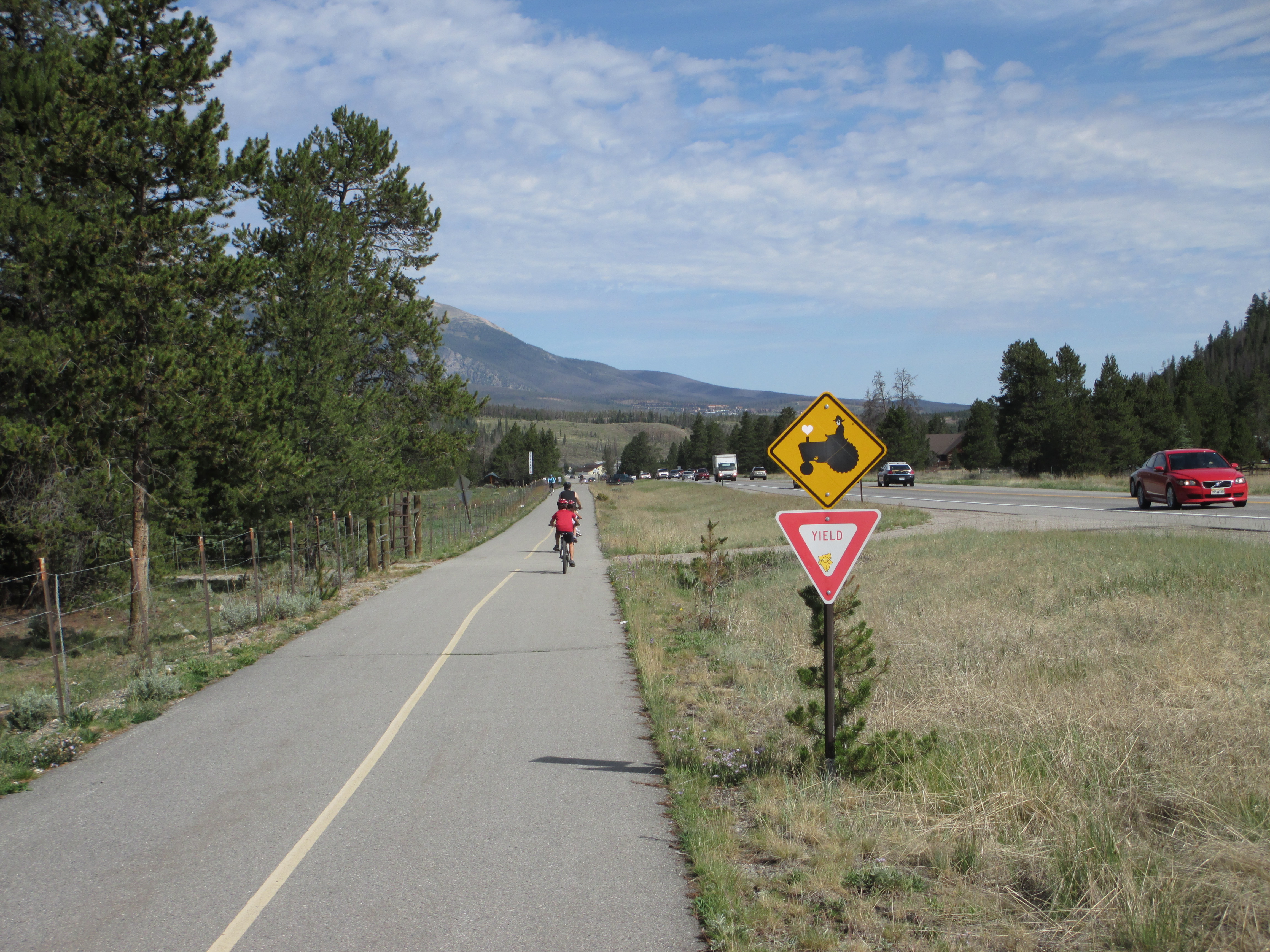
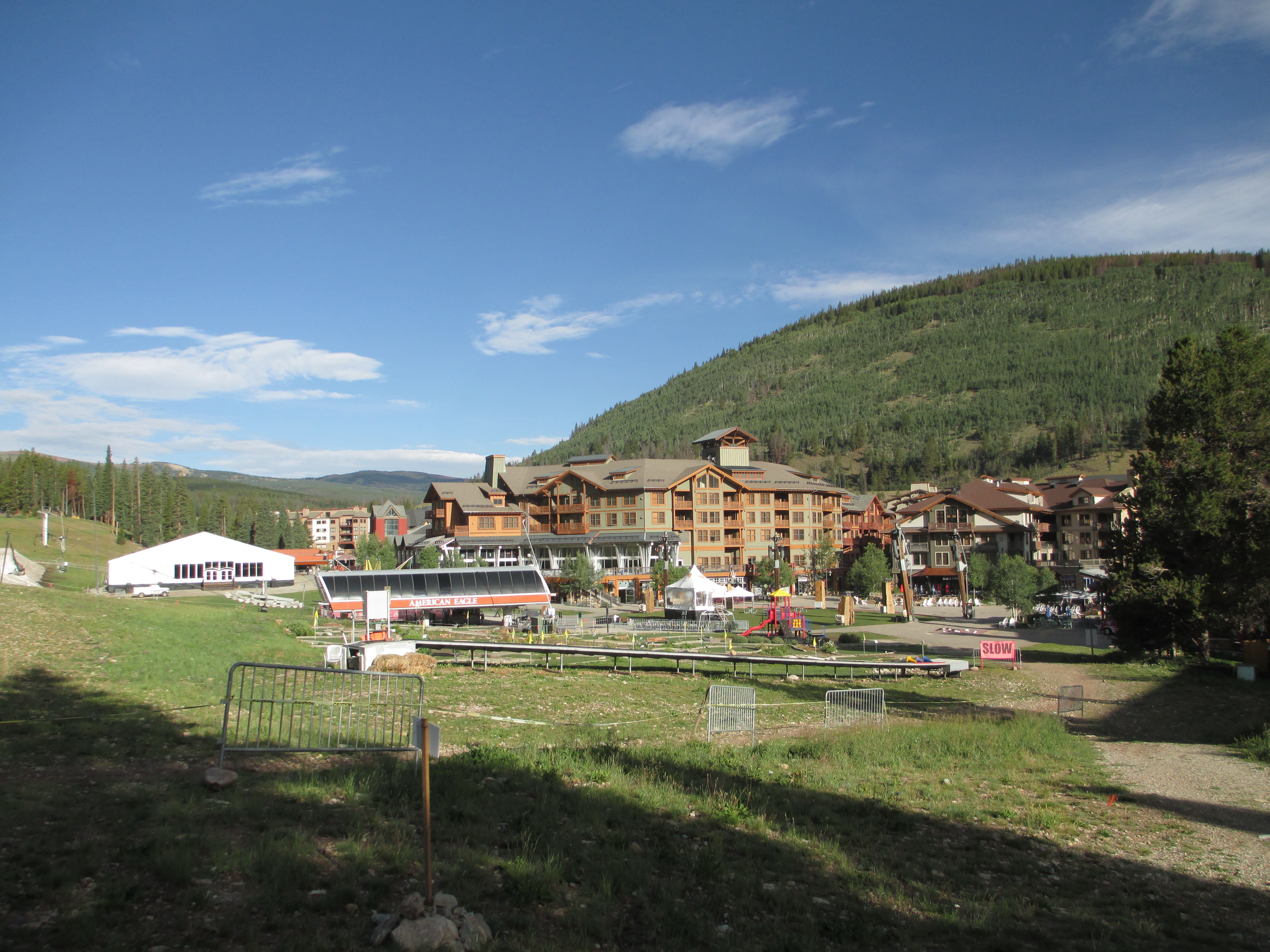
After emerging from the other side of the forest, a woman who was walking her dog came around the corner,startling me. She commented to the dog that someone was walking on his path… There were condos on the other side. I came to Copperhead Ski Resort, which reminded me of Switzerland and my Swiss friend. I thought it was a place he would definitely hang out at.
It would have been nice to get something to eat there, but I decided to save my money and time and continue on.
IMG_0357
On the climb up the next hill, I stopped to put on my visor and sunscreen. A group of younger people started the climb after me and I quickly went on.
IMG_0361
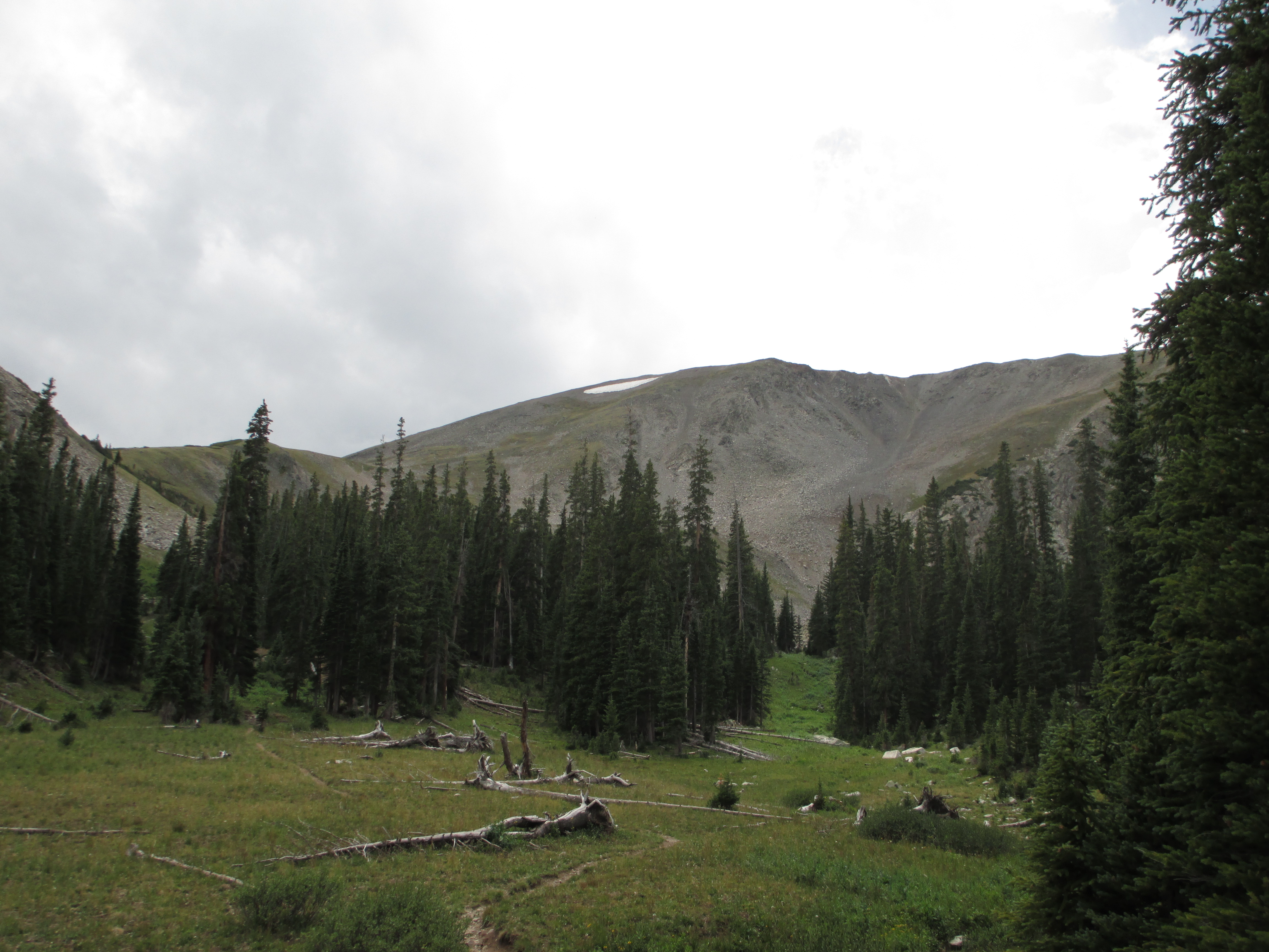
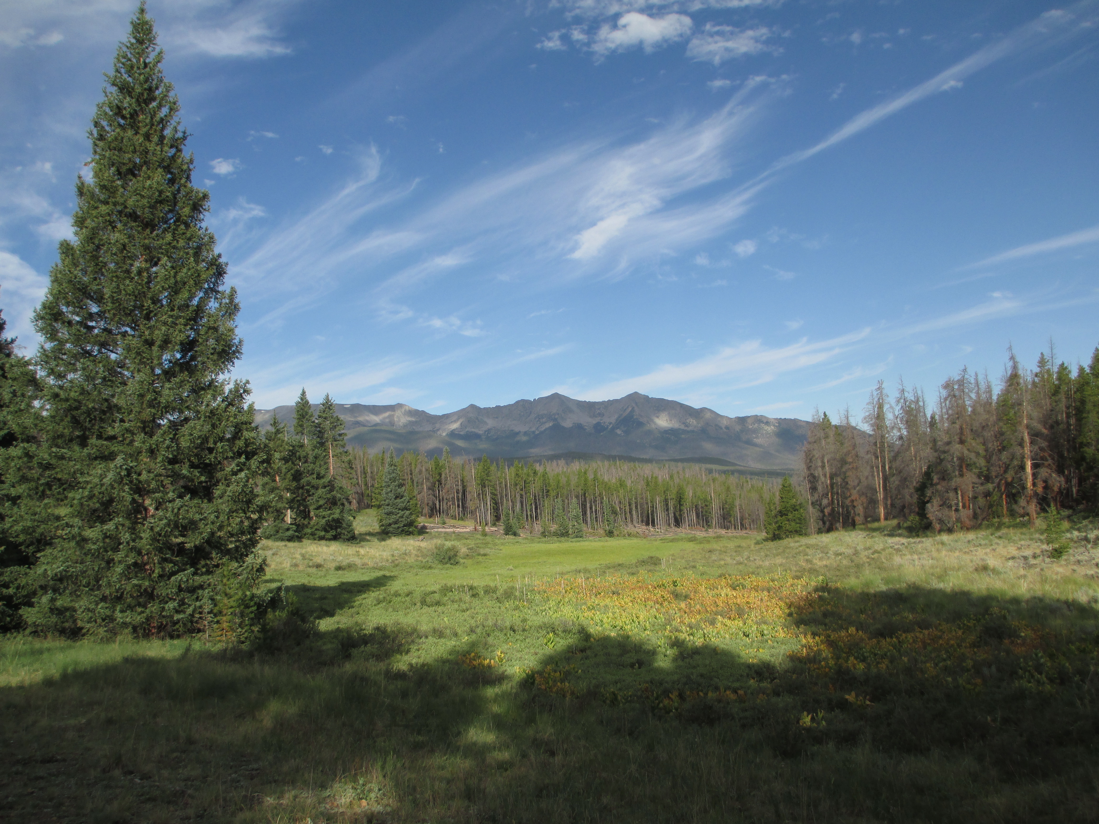
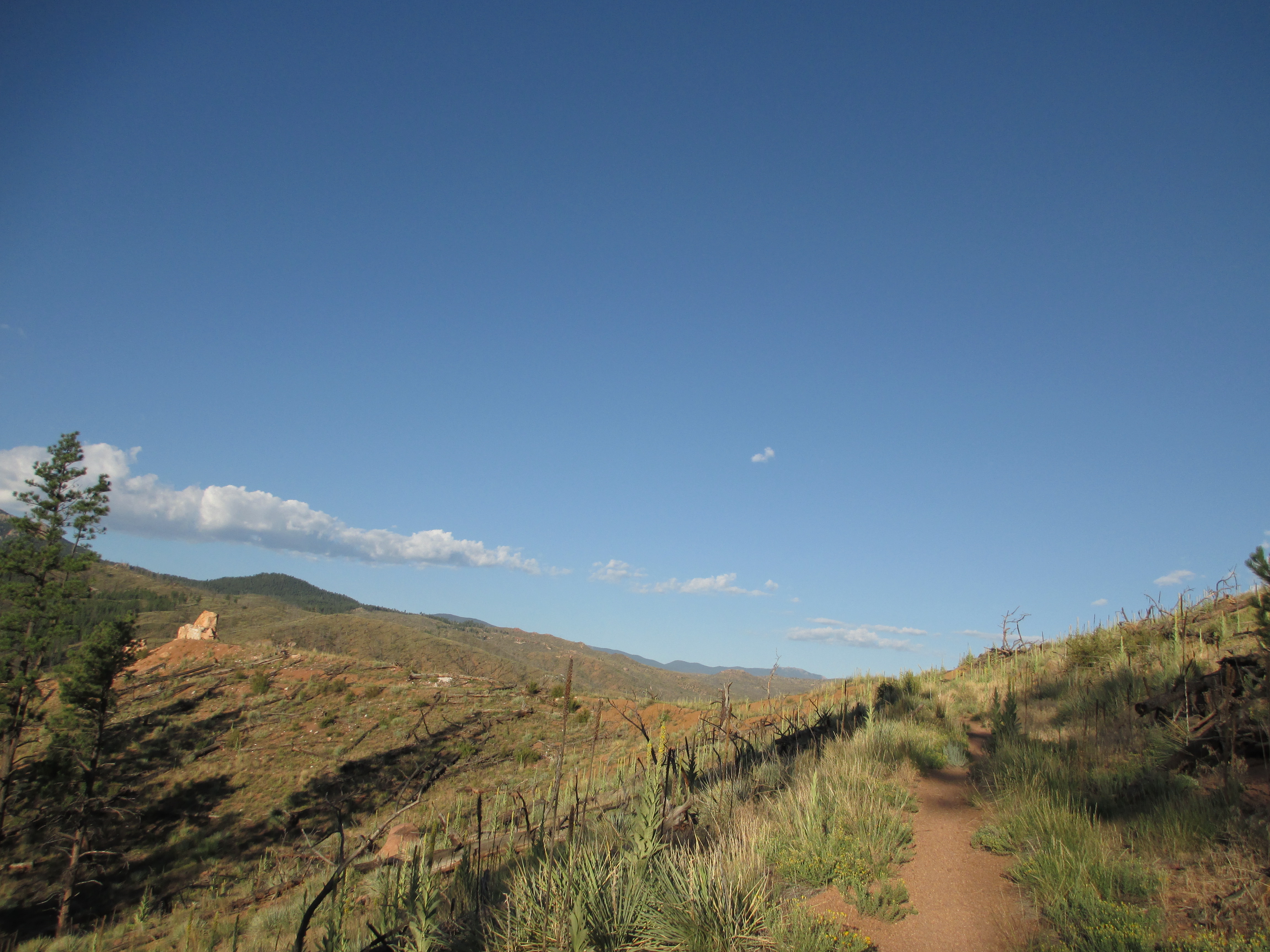
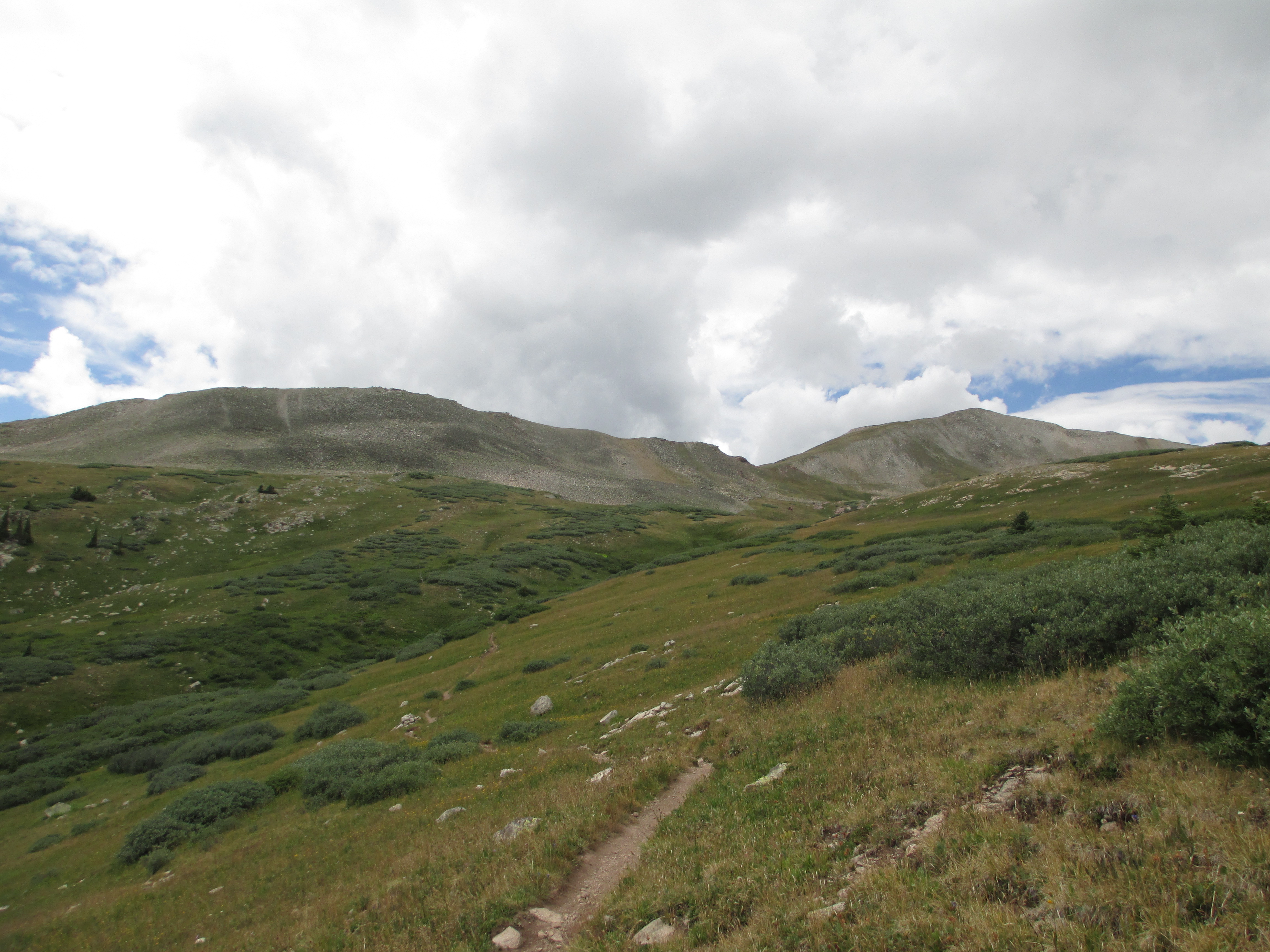
A bit later, I caught up to a father and son who were out on a day hike. They let me pass them as I was moving more quickly, but they passed me back after I took a break to eat a plum that I had brought from Breckenridge. They went up a grassy hill while I continued on the CT, into the woods, heading for my second long stretch (4.8 miles) of exposed terrain- Searle Pass.
IMG_0368IMG_0374IMG_0378
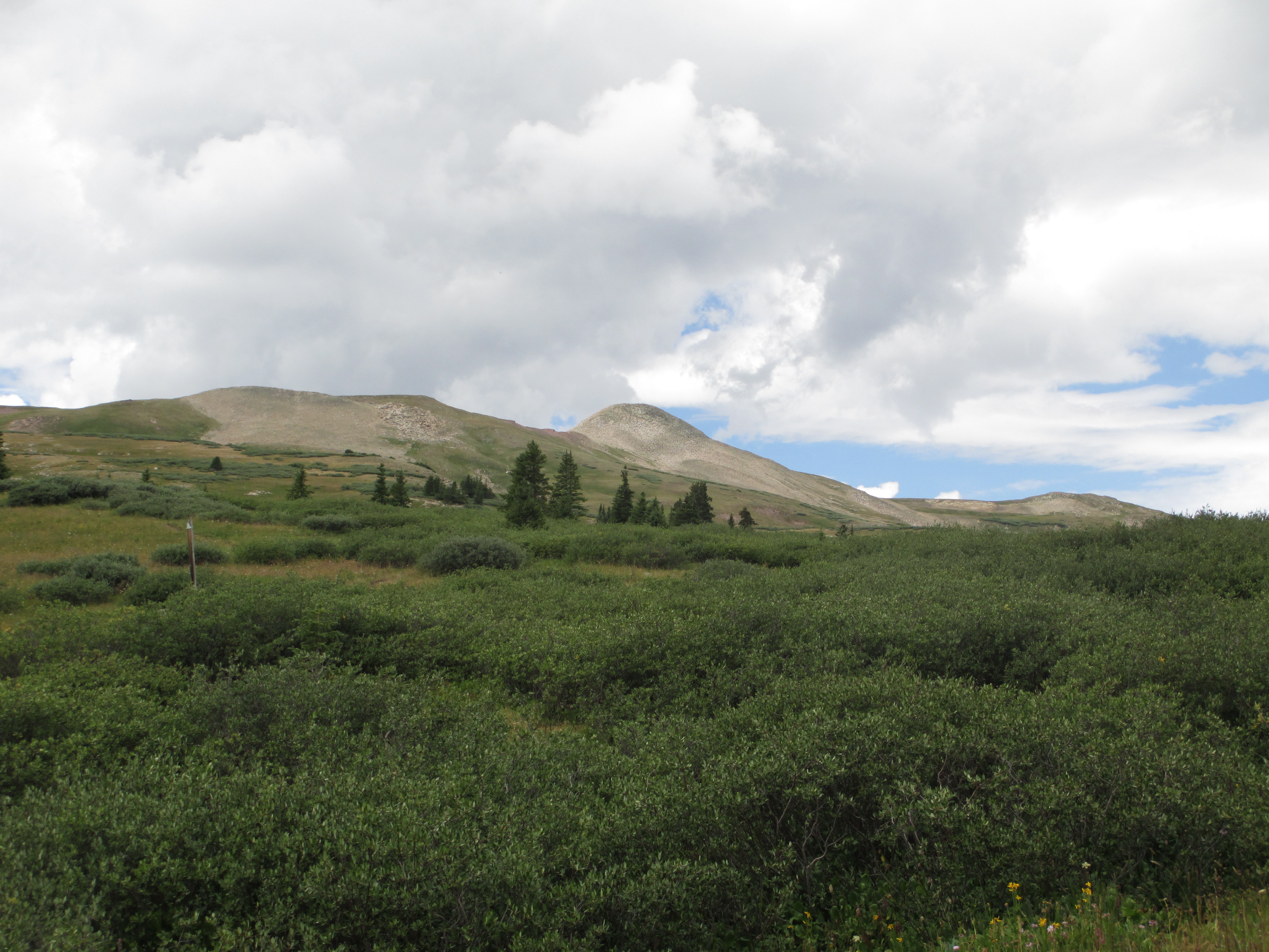
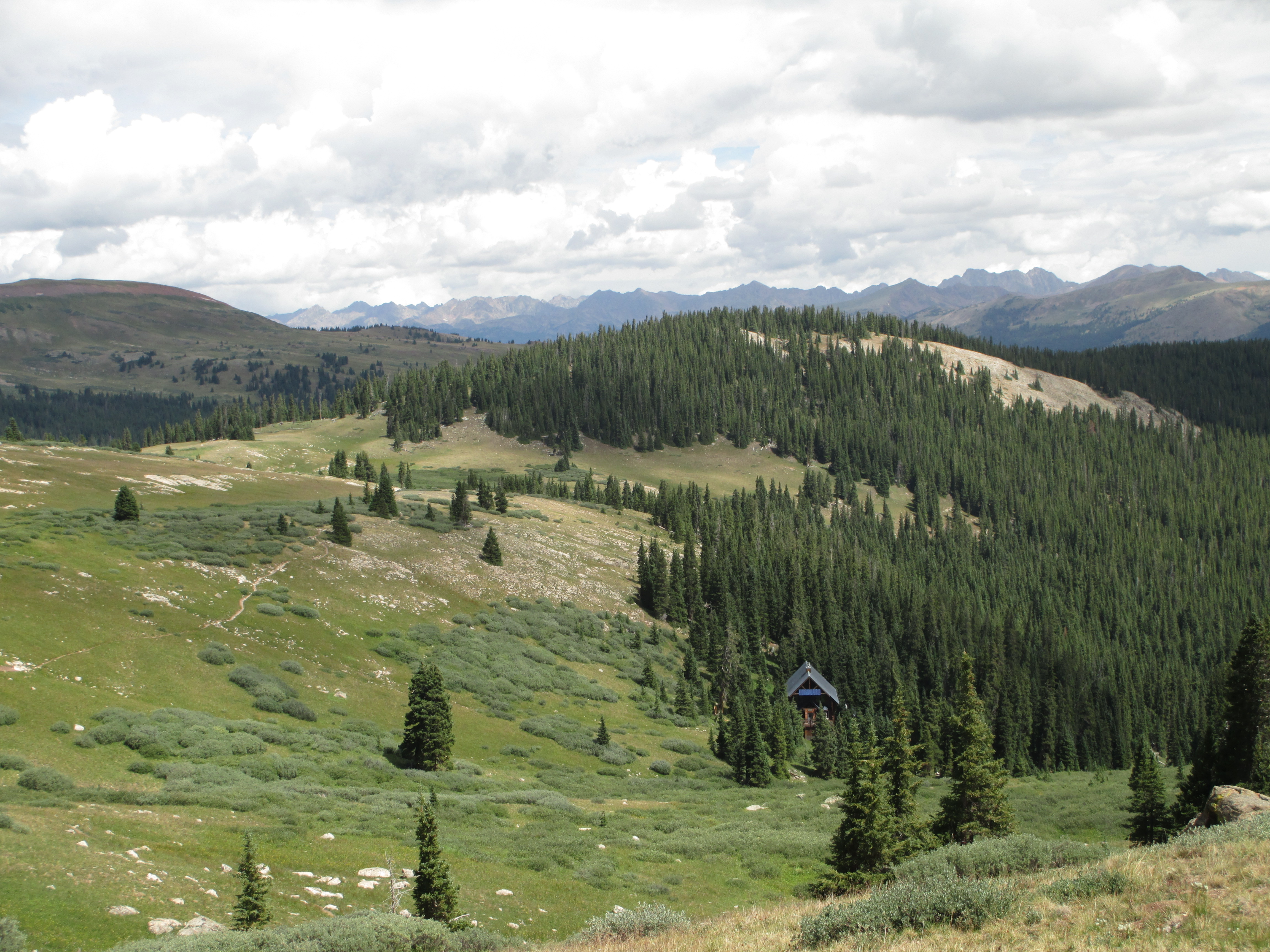
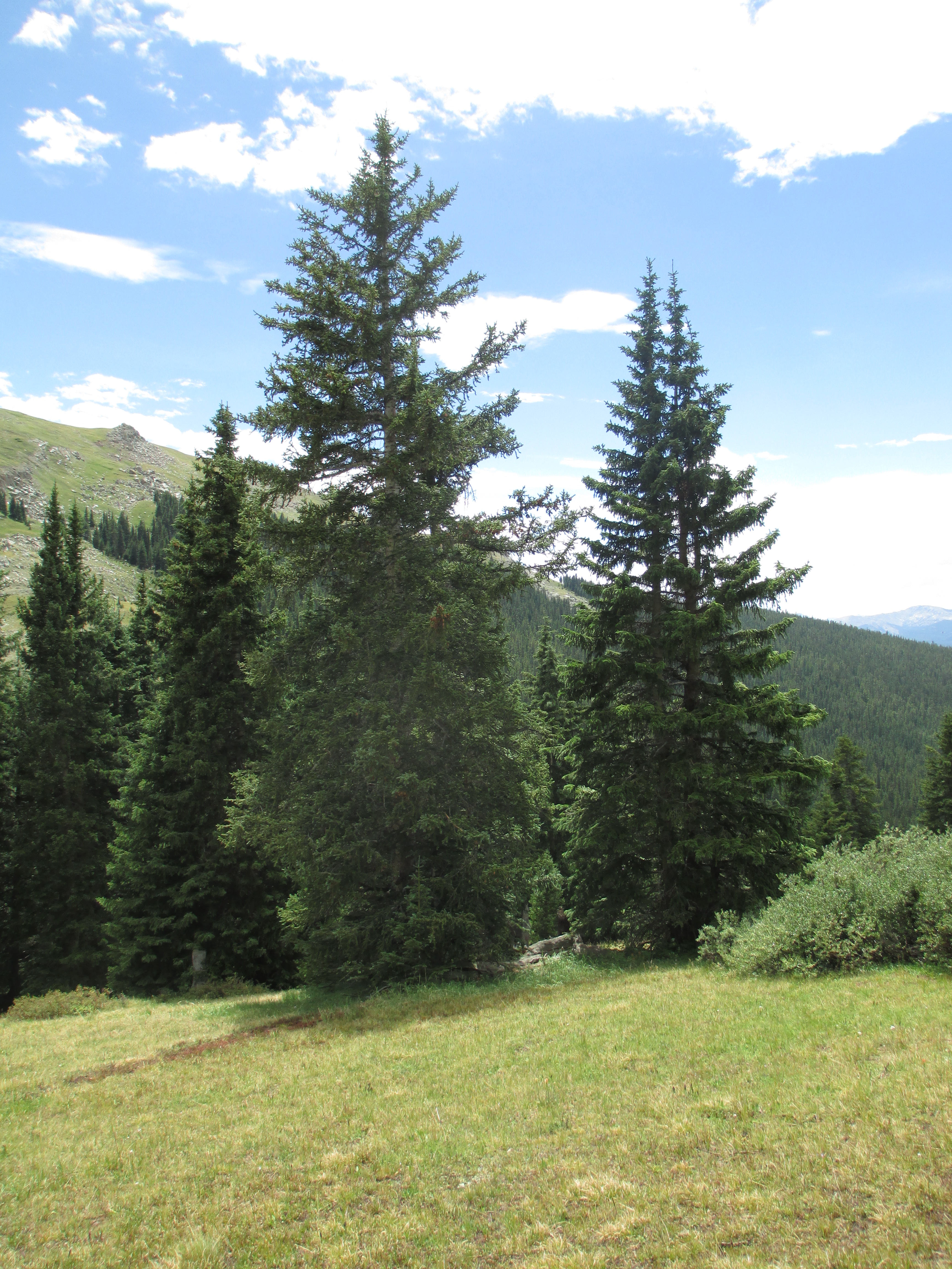
I saw a ski hut in the evergreens, which again made me think of Switzerland. And then, I was out in the open again! My favorite part!
IMG_0389
IMG_0387

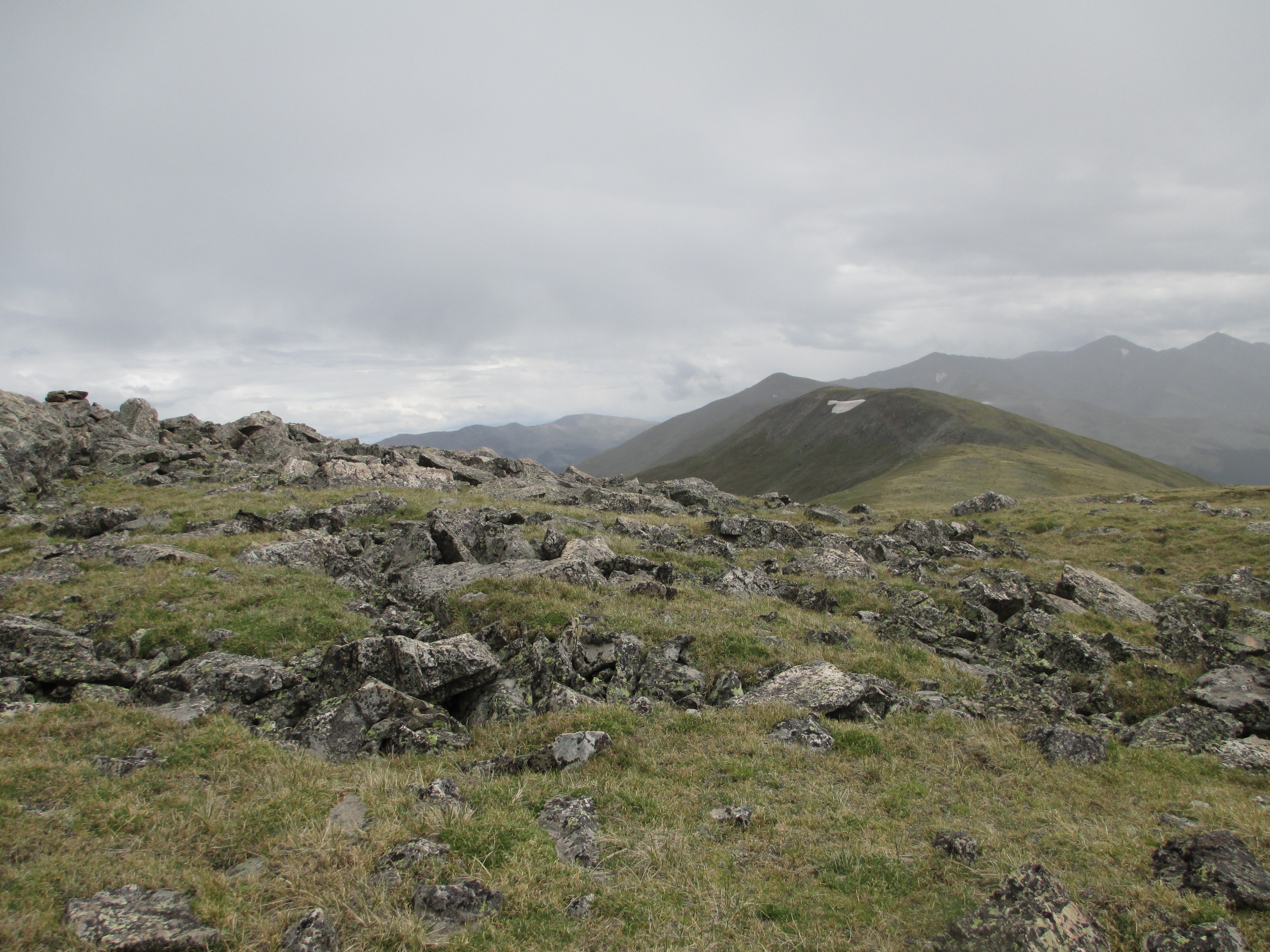
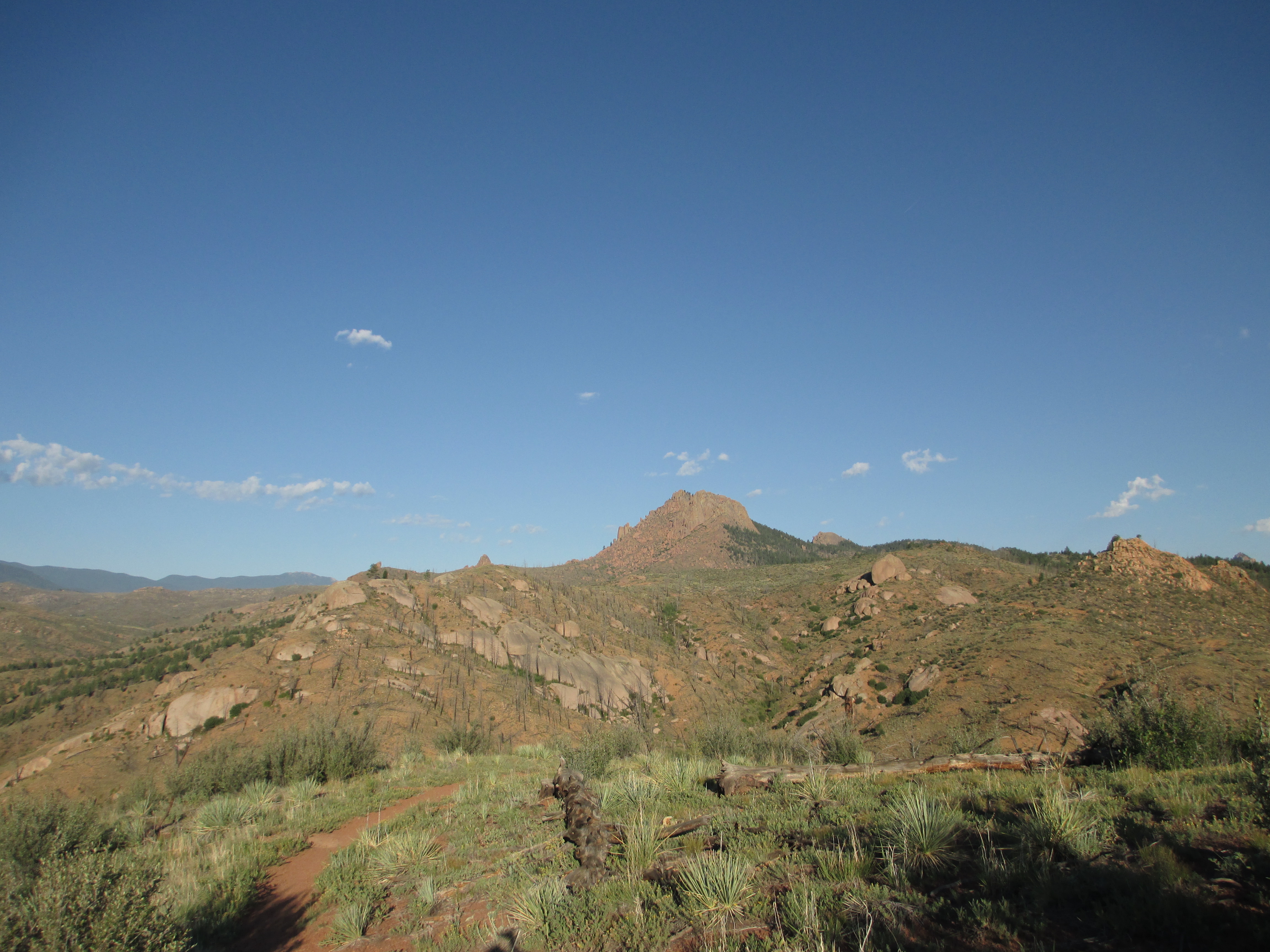
I got to the highest point that I could see, saw a nice flat rock to sit down on and have lunch, then looked behind me to see big, dark clouds! Oh, no… The wind quickly picked up, the temperature rapidly dropped, and it began sprinkling. So much for enjoying lunch… I put on my rain jacket and moved on.
IMG_0394
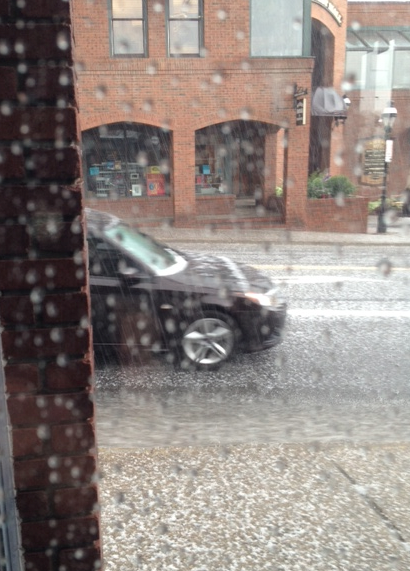
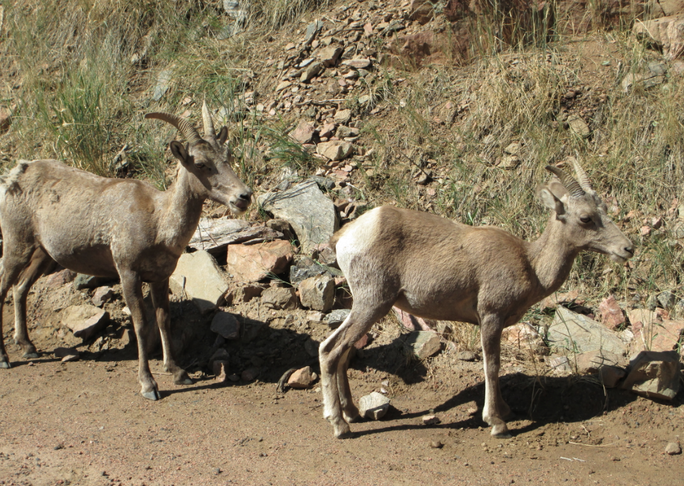
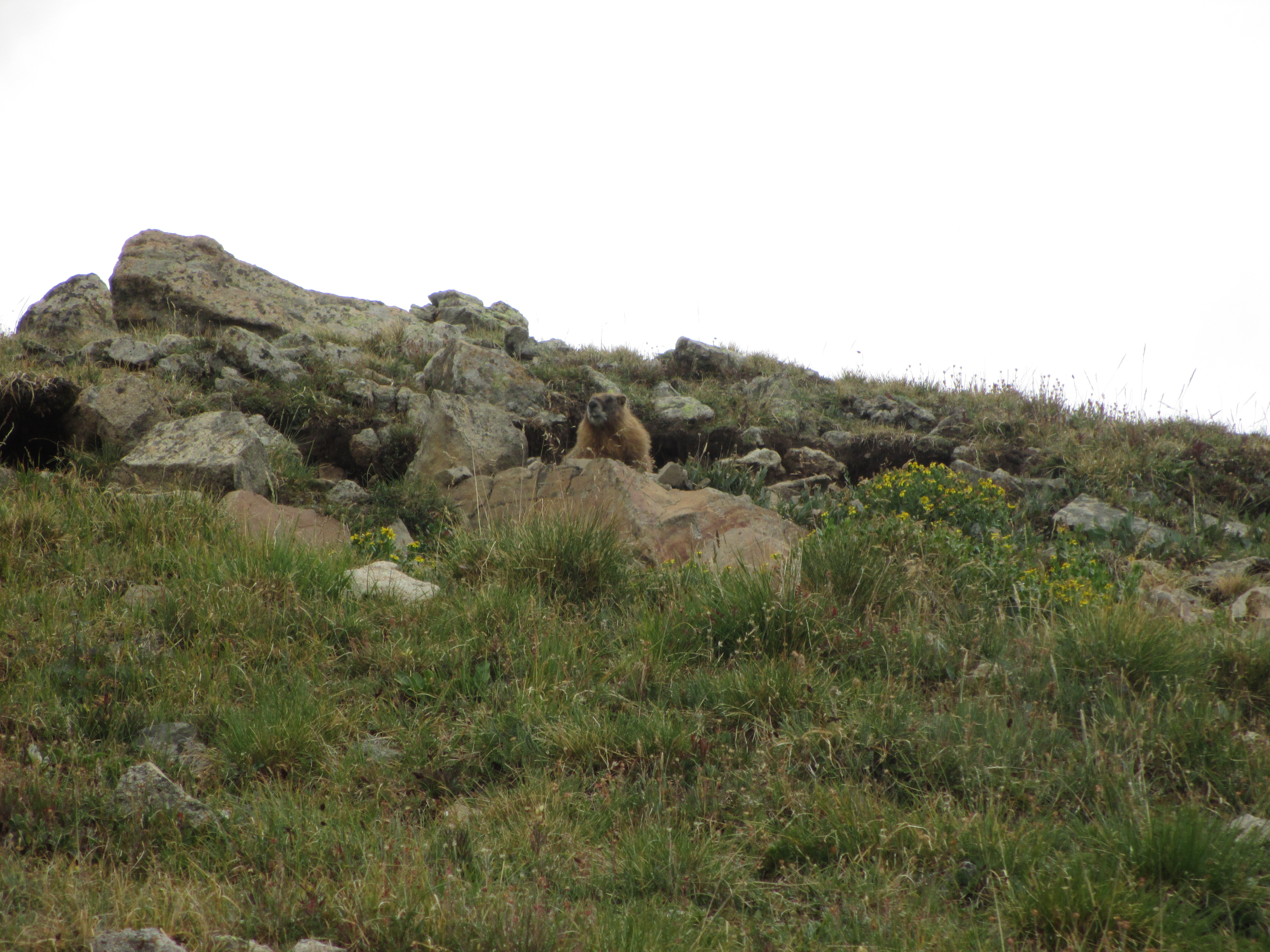
The rain turned to hail… It pelted my hands and bare legs. All I could do was keep moving forward. I thought about people at home, enjoying themselves in comfort as the hail stung my skin. I wished I could enjoy the views in these open areas without racing away from storms! The hail eventually turned to rain, and then stopped altogether. I still hadn’t reached the highest part of this section at mile 12.3. I heard and saw both marmots and pikas. A family of 5 or so marmots poked their heads out of the rocks and watched me walk by. So cute!
IMG_0399
Rain still sputtered and I continued to move.
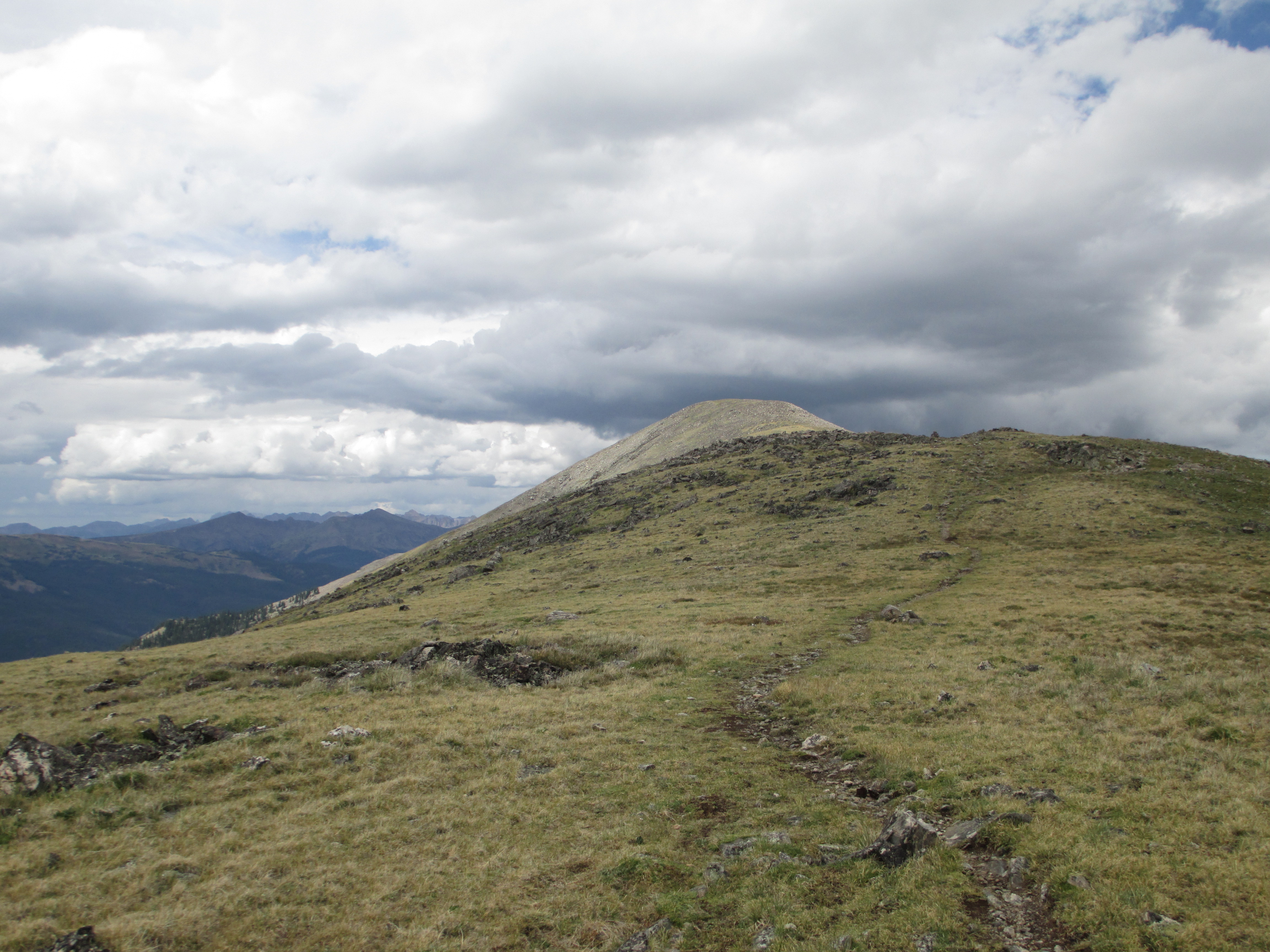
I finally reached the high point, and the trail started to descend.
IMG_0405
I could see treeline in the distance. Then, I saw flashes of lightning! I picked up my pace, hiking as fast as I could as lightning bolts flashed in the sky. Finally I made it to treeline- safety! The rain picked up in intensity again. Lightning was again striking.
IMG_0407
I headed off the trail to 2 pine trees, which I felt were protecting me from the lightning and keeping me somewhat dry. I waited for 10 minutes until it seemed as though the storm was passing.
IMG_0408
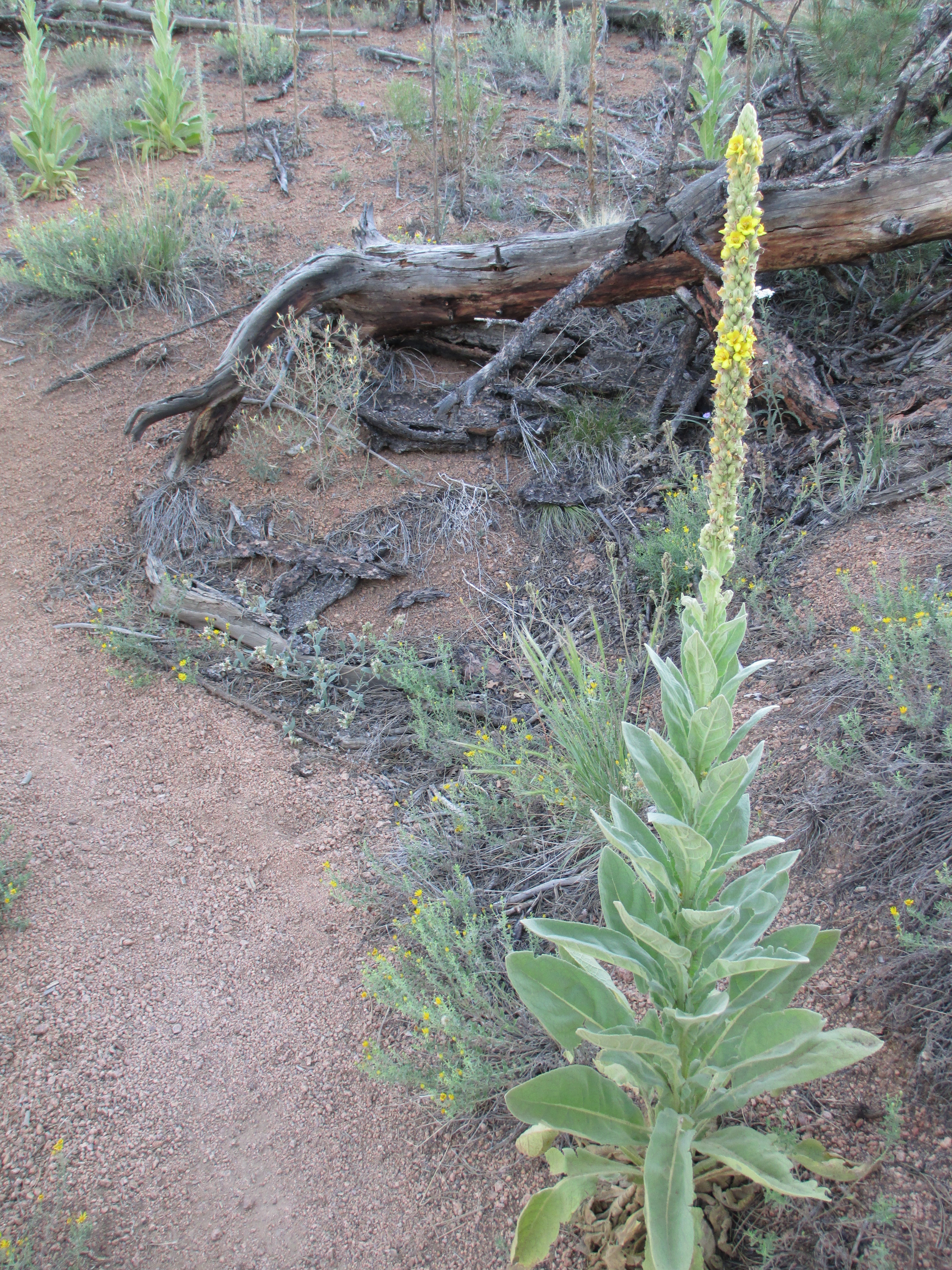
Again, I pressed on, downhill, heading towards a dirt road. And again, the rain started. I saw the headlights of a car approaching me. It passed me by without acknowledgement. I walked on a path along the road, in the rain, eventually crossing the road and heading towards the forest once again. I saw a flat spot underneath a couple of trees at the end of the road and thought about setting up camp there. But then I saw some spooky bunkers nearby, and decided it would be best to continue on! I climbed another mile. My guidebook said there was a great campsite 0.1 miles from this point, but I saw nothing! So, I pressed on, growing more tired, hungry, and demoralized by the minute. I reached a bench a few minutes later, pulled out a power bar, and wondered if I should change plans and try to hike 5 more miles and hitch the 9 miles into town tonight. I didn’t know if there were any camping spots in the next five miles. I would be exhausted and wouldn’t reach the trailhead until 7:30 (after having hiked 26 miles that day), but I would be able to spend the night out of the rain. I put my pack back on and pressed on. Not long after, I saw a bit of flat ground, looked into the woods in that direction and saw a place to camp! That was it! I was stopping for the day.
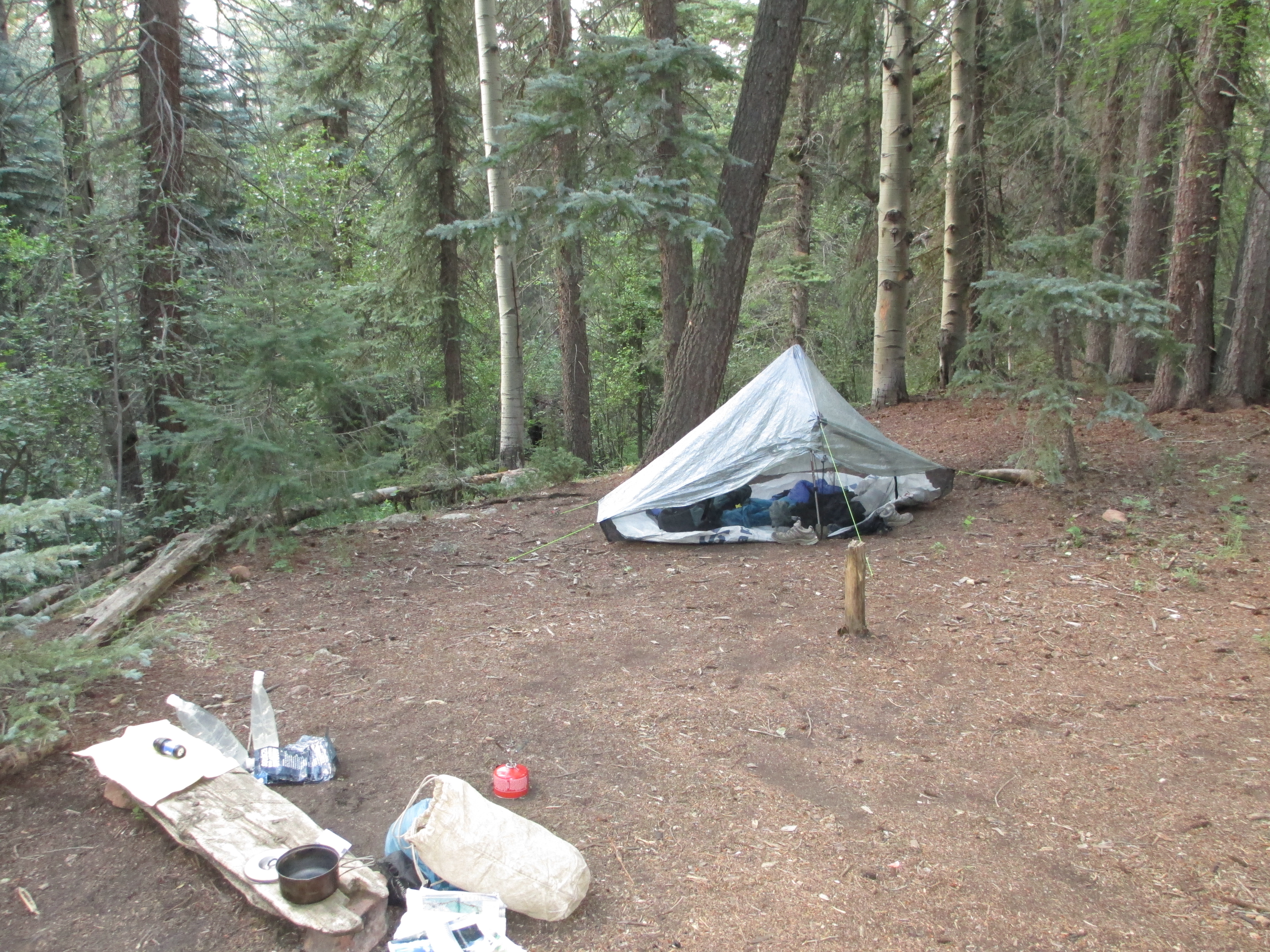
I had to set up my tent on some tree roots. I unpacked my sleeping bag, got things set up, then took my stove out to cook some dinner. It then started sprinkling again! Fine- I guess I will just rest in my tent for awhile…I tried to lie down and relax. I woke up about 20-30 minutes later to the sound of steadier rain. It was really starting to come down! And then, I noticed it flooding my tent- in all directions! My sleeping bag was getting wet (it’s really bad to get down wet because it loses its insulation properties and takes forever to dry!), and water was running underneath my sleeping pad! It was a nightmare! For the next 2 hours, I tried to triage the situation. I tried to mop up the puddles with toilet paper. I didn’t have my rain beak staked out, so I was trying to hold it away from the mesh wall of my tent to prevent more water from dripping in… I managed to nibble on a few snacks, but I didn’t feel very hungry. I was just exhausted.
At 8:00, I decided that the drops I heard falling on my tent were coming from the trees and that the rain had let up, so I got out to pee and brush my teeth. I tried to get some sleep, but all night long, water dripped on my tent from the pine needles above me.

This was a very difficult day! (And I managed to lose one of my Crocs, too…)

Day 8 of the Colorado Trail

July 28

12.4 miles

I got up just after 7, with a lot on my mind. Not only did I still need to find a way to get my guidebook pages, but I also had an additional challenge. The next section involved an 8 mile climb up to 12,500 feet, with 4 miles of exposed terrain. Treeline would not be found until mile 9.9. Due to the daily storms and lightning, it isn’t smart to be above treeline in the afternoons, necessitating an early start. But getting out of town early is very hard to do. Breakfast wouldn’t be served until 8:30, and I still needed to have my pages faxed, and then pack everything up. The earliest possible bus I could take would get me to the trailhead at 10:30. I would hit the exposed terrain at the most dangerous time of day. I contemplated spending another day in town, but didn’t know if the hostel was fully booked or not.
Breakfast was good (scrambled eggs, coffee, a couple of small slices of fruit, and french toast), but the conversation was not very congenial. Half of the table were cyclists from New Zealand who came to tour the Colorado mountains, and the others were tourists on vacation. I was the only hiker. I tried talking to the cyclists, but it didn’t go anywhere, and no one was interested in what I was doing. I felt SO lonely in the midst of all these people and desperately missed the two Swiss guys that I ate dinner with in a hut on my last night of my hike in the Swiss Alps. They were so kind and friendly! (Why is this so rare?)
David faxed me the pages I needed, for which I was charged $1/page. (My saviour!) I re-packed everything and walked to the bus station. I decided that if the skies looked threatening, I could at least get six miles in. I was let out at Highway 9, just where I had crossed the road yesterday morning at 9:30 am- before walking a long way in the opposite direction of Breckenridge! Oh, well. I had to let that bad day go and open myself to a new start.
I began the climb (which always feels much better after having real food), and found a fork in the trail at mile 1. I took out my guidebook pages. They said nothing. A cyclist came up behind me and I asked him if the trail to the left was the CT. He told me there was a swing at the end of the path (not far away). He didn’t know who had put it there. “You’re almost at the top!” he called back as he sped away. I decided to check out the swing. (I don’t often take moments of pure relaxation). My mind contemplated how the person who was so mean to me and threatened never to talk to me again the night before my hike was the person offering to do the most for me a week later, and checking to see if I was alive and okay the most frequently. I found that to be so strange and confusing!
IMG_0299IMG_0298
I continued on. The trail was steep and slow-going at times and I sometimes had to stop to catch my breath. And then, the trail started going down and down! I wasn’t sure I was on the right trail! I was certainly losing all of the altitude I had just worked so hard to gain! I passed some day hikers, who had no packs, as well as other people sitting down. In general, I felt strong and good, and was making good time. I sat down for a break at one point and looked at my sunburned wrist. It was bubbling! (I’m not used to such strong sun!)
IMG_0301
Soon, I reached mile 6, where I had to decide if I was going to camp and get up early to do the 4 miles of exposed terrain, or risk the storms. The climb was getting steeper and steeper, and I had to rest more often. It started to sprinkle already, but there were some puffy clouds and blue sky in parts of the sky. I passed an obnoxious group of kids on mountain bikes, and then two tents and a barking dog who obviously didn’t want me there. I was now creeping up to tree line and decided that I would risk the pass!
As soon as I stepped into the tundra, I heard the familiar sound of marmots (that I had seen and heard in Switzerland)! How happy that made me! I felt at home! And the views were stunning! Finally! I could see a huge lake below me and beautiful mountains all around me.
IMG_0307IMG_0309IMG_0313IMG_0315
I started climbing again, stopped, breathed, and continued again. (The altitude made climbing harder than I have ever experienced it before!) I continuously checked the sky. There were always some puffy, white clouds, and some darker clouds in another area of the sky. I could see rain over Breckenridge and some distant mountains. It looked very dark- almost black. Behind me, the sky was gorgeous! I hoped the wind was moving the good weather in my direction, or at least that the rain would stop by the time I made it farther along.
It did not. It started sprinkling again, and then the rain got steadier. I kept eying the krumholz, deciding I would dive into this low vegetation if lightning struck. The trail continued to climb. It was tough work! I had to stop often. It felt like I was only moving one mile per hour!
IMG_0317IMG_0322IMG_0324IMG_0334
Finally, it started descending! And there was no lightning! I got lucky! Even though the views were obscured with the clouds, it was amazing to be in this exposed terrain. And it was just me out there! Just me, and the mountains, and the rain, and the birds, and the little pikas!
IMG_0337
The skies darkened on the opposite side of the summit, so I decided to only sit down and eat a bite when I was closer to treeline.
The descent was steep and my knees were not happy. Finally, I was safely back among the trees!
I walked about 2 more miles and found a campsite just over the river and bridge. I heard sounds from the highway (0.4 miles away). I ate Thai noodles, a Hershey bar with almonds, and a power bar, and collected more water. It started to sprinkle again around 6:40, so I went inside my tent and journaled. The rain stopped about an hour later, so I went out to brush my teeth. The temperature had already dropped from 60 degrees to 50. It was 8:01 and I was ready for bed!
Tomorrow, I have a 13 mile climb!
IMG_0350

Day 7 of the Colorado Trail

July 27

6.8 miles + (a lot more…)

(Bad day 😦 )

IMG_0278

I got up around 6, ate some granola in bed, packed up, and hit the trail at 7:07. Soon after, I heard some noise in the forest. I looked over to see the guy who had passed by last evening! So he didn’t make it to Breckenridge on day 6 after all! He waved and I continued on. My competitive instincts (which have been greatly reduced by my yoga practice) suddenly kicked in! I wasn’t going to let him catch me! I wanted to be the winner! 🙂
The power line that I was looking for last night turned out to be a long way away! I was glad I stopped where I did. I felt like I was moving very slowly. The sun started burning down again, so I put on sunscreen. I decided to wear my bandana instead of my visor because I was only hiking 6.8 miles. The route went up and down, and at one fork, I was very confused as to which way to go. I followed my instincts, and luckily chose correctly!
Later on, I saw a grey, tattered bandana on the ground, and nearby, a dead squirrel! That was an eerie site!
IMG_0282
IMG_0283
At last, I started descending the switchbacks overlooking a resort town.
IMG_0285
As I made my way to the bottom, I saw a family fishing in the lake, walked around the lake to cross a bridge, then a road, and then another bridge. I thought I only had a 0.4 mile walk to the trailhead. I was wrong. I still needed to cross Highway 9- a major, very busy highway! I made it across, but was confused about where to go next. I almost started up the wrong trail and then realized the CT continued on the pavement, crossing a bridge. The guidebook said the end of the segment and trailhead was 1/2 mile after Highway 9, and the bus stop was supposedly a couple hundred yards away. I came to a trailhead much sooner than 1/2 mile and was confused again. I asked some people who were about to start a hike if they knew what this trailhead was called. They weren’t very nice and didn’t know the name of the trailhead. They just mumbled something about Pike’s Peak. I told them I needed to get the Summit Stage bus into Breckenridge. They pointed me in the direction I had just come from, but I thought it was further ahead. So, I kept walking- and walking- and walking, looking for another trailhead. There was no second trailhead- only runners and bikers on a path!
IMG_0289
The sun continued to beat down on me. I was walking much further than the 6.8 miles I was supposed to have. I was demoralized, hot, and drained of energy. I finally asked a girl who was running where the next bus stop was. She said it was a mile away- in front of the high school. A mile! My guidebook was wrong! I had no choice but to keep going. I stopped in at a design center to ask where the high school was. When they found out what I was doing, the woman put her hands in prayer and bowed to me (!). Both the man and woman were in awe that I was doing this alone. She wanted to mountain bike the trail in the near future. At a garden center, I asked for directions again. Finally, I found the high school and fortunately didn’t have to wait too long at the stop. But the bus driver was so mean to me (three times)! He was extremely rude when I asked him which stop I should get off. At least there was a nice older couple who seemed interested in what I was doing.
After arriving at Breckenridge Station I used the restroom (I was very dehydrated!) and then asked the gondola entrance man where N.French St. was. It was far away! Finally, I found the hostel. No one seemed to be there. I went in and ended up startling the lady. She asked if I had a reservation. Not having had to make reservations at most of the places on the AT, I didn’t expect to do it out here, either. But this was a different situation. All summer long, mountain bikers and tourists were occupying hostels, as well as hikers. Only because of a cancellation that day, was I allowed to stay in one of the bunk beds. She asked if I had a package sent there and I said I did. However, they didn’t have it! They asked if I had sent it by US mail, telling me their residence wasn’t allowed to have US mail delivered there because it was a historical site. The post office most likely sent my box back home! There was only a small chance that they held it. I walked all the way to the post office, waited in the long line, told them my situation, and was immediately told (without checking) that my box was sent home. The lady then pulled out a town map, showing me where the grocery store was so I could buy new supplies there. I was so upset! I was dirty, exhausted, and now I didn’t have any of my food, supplies (including contacts and sunscreen), and most importantly my guidebook pages for the next section! On each side of the box, I had written “Hold for Hiker, ETA 7/28” and they just sent it back? Tears welled up in my eyes. The lady behind the counter told me this would make me stronger. As if I hadn’t already been through enough to make me strong…!
I walked back to the hostel, texted my “friend” to let him know the bad news and e-mailed Erik. My “friend” actually asked if he could fetch the box and Fed-ex it to me. Really? He would do that? I didn’t know anyone else in my life who would be willing to do that for me! (and this from the person who had ripped into me a week ago? Confusing…) I called my landlord and left him a message, asking him if the package had arrived back home.
I finally took a shower and headed off in search of a meal. I ended up going to a small, popular pizza and pasta place. I felt a bit lonely (it always feels lonely to be eating in a restaurant alone, while traveling, and everyone else has companions). I ordered a green salad and a glass of water to start. The waiter asked me if I wanted bread. “Is it free? Then, yes.” I ended up eating almost the entire basket! I wanted a slice or two of pizza, but they didn’t sell slices, so I ordered a chicken parmesan sandwich. While I waited, I kept eying the leftovers on other people’s tables, but refrained from asking if I could have them…I checked my e-mail and my landlord’s son had written back, telling me that they had my package and that he could ship it overnight! I could relax!
A party of three came in and sat down at the table to the right of me. The guy next to me kept looking at my sandwich and finally commented on how big it was and that I was making good progress! I responded, “I just hiked 105 miles!” The woman’s eyes grew wide and she started asking me questions. It was nice to have people to talk to. She said that I was the most fascinating person she had ever met because of what I was doing. She told me about their trips to Alaska and said that I would love it there. They each had a glass of wine, and after going back and forth on whether I should have one, too, I finally decided to order one. After hearing about my ordeal with my package, they were glad that I got myself some wine, too. While we ate, there was a tremendous hailstorm! Within minutes, the cars all had snow on their windshields, and a gushing river was racing down the sides of the street! I was so thankful that I was inside eating at this time!
Screen shot 2013-03-19 at 12.01.58 PM
Another hiking couple had also come into eat and were attracting the attention of their table neighbors. Finally, I saw some people like me! They were hiking the Continental Divide Trail (but only for 6 weeks). And they had the strength and discipline to come into town, eat as much as they could, resupply, and get back on the trail in the same day! That is never something I like to do.
The woman next to me continued to ask me questions. Her husband was embarrassed and thought she was bothering me, but I loved it! They got up and said goodbye. A few minutes later, the waitress came by to tell me that they paid for my meal! Incredible! I felt like this helped with the extra resupplies I now had to pay for.
I headed for the grocery store at the opposite end of town and checked my e-mail along the way. David had written again to tell me that my resupply box had actually not yet been returned (the box they had was the things I had sent back from Fairplay). I decided to turn around and walk all the way back to the post office to see if they would check General Delivery. (The post office was in the other direction…) They checked and it was not there. So, it was in transit back to my apartment.
I again headed all the way to the opposite end of town. The grocery store was expensive! I paid $30 for some power bars, a few candy bars, a couple pieces of fruit, sunscreen, and a cheap contact lens holder. I still had to figure out how to get copies of the guidebook pages that I needed. As I headed back to the hostel, it started storming again! Rain, thunder, and lightning! The hostel didn’t have a copy of the Colorado Trail guidebook. The woman called the Alpine Store to see if they had it, but they had sold their last copy that afternoon! How was it that I was hiking the Colorado Trail and could not find a copy of the guidebook in Colorado? In a town that was 3 1/2 miles away from the trail?
The Olympic Opening Ceremonies were on that night and I wanted to watch them. I expected them to start at 8pm, but they were starting at 6:30! I quickly headed back into town to find some dinner. The organic place that the hostel owners recommended was only open for lunch, so I continued on. It started raining again and I was having trouble finding a place. They were either too fancy, or too dumpy. I was getting cold and wet. I stopped in at an outfitter to see if they had the guidebook. They did not and recommended I try the bookstore. I went to the bookstore and saw that they were closed from July 27-31 and about to go out of business. Great! I was now very cold. I poked my head inside a tavern and they said I could sit at the bar. I ordered coffee and a giant bacon cheeseburger. I needed food and warmth. Luckily, it was happy hour, so it only cost me $11.37!
I returned to the hostel and, all night long, made phone calls, wrote e-mails, and sent texts (which cost me money) to people back home to see if someone could find my guidebook and copy the pages I needed. All I wanted to do was relax and watch the Opening Ceremonies, but I was not able to see them at all. My guidebook was not in my desk drawer at work, so it must have been in my apartment. My landlord had to search my messy apartment for it (I told him it was probably in one of 2 places), and once he found it, had to drive to his workplace and scan the needed pages. He e-mailed them to me, but because the files were too large, I got nothing! All night long, I worked on this problem and didn’t get into my bunk until after 11pm. A traveling couple came into the room after midnight, making sounds throughout the night. The man was snoring, kept scratching himself, tossed and turned, and people would get up to go to the bathroom. Although my sleep was very broken and disturbed, I slept harder than I had all week in the moments that I did sleep.
Today was a very tough day!

Day 2 of the Colorado Trail

16.6 miles

It was a tough night of trying to sleep, as I was set up on a slope, with my head downhill! Everything ended up in that corner, and my sleeping pad (the thinnest possible piece of foam) crumpled up underneath me and felt like a rock. I woke up hot (which felt unusual for sleeping outside, but I guess I had never slept in such a warm climate before). I got up at 5:15, ate a poptart and a little granola, drank some water, and got ready. I crossed over the river for the final time, set my pack down and collected and filtered a bit more water, which was so much colder than the evening before! It was 60 degrees and I wore my fleece jacket and rain gear for warmth. As I climbed the switchbacks, I quickly became warm and had to take off my layers. I could already see the sun shining on the exposed areas above me. I put on sunscreen and prepared myself for the shadeless section. It would be my first time in a desert-like environment, and I appreciated the preview for my PCT hike. Although the trees had burned down, desert plants and flowers were blooming and provided interest along this section.
IMG_0067IMG_0069IMG_0072IMG_0074
I had to stop every half hour to take my pack off my shoulders and give them a rest, just as I had done on the AT. At 8:45, as I was trying to photograph an orange flower (this new camera I bought for the trip was doing a poor job of taking close-ups!), Dave caught up to me. He didn’t manage to wake up as early as he had wanted and left at 6:45. I saw some bones that someone had displayed on a tree and tried to take a couple of pictures. (I never feel comfortable taking photographs when hiking with people because they also seem to want to keep moving).
IMG_0075IMG_0076
After 30 minutes, I again had to take off my pack (this is also hard for other people to understand, as it only seems to happen to me!). I wished I could be hiking alone, where no one could hear my labored breathing, and where I could stop and rest and take pictures when I needed to. Dave wanted to find a nice place to take a snack break, and I finally found a suitable area after desperately needing to take my pack off again. Since I had already snacked and knew I needed to stop frequently, I wanted to continue. I told him that I was going to go on, but that he would surely catch me quickly. (He did not!). I walked through a short section of forest that managed to escape the fire, and then continued through more burnt areas. When I came to a large rock, I felt so grateful for a piece of shade! You quickly appreciate the smallest things when out in the elements all day long. The temperature had climbed to 91 degrees. My feet started to drag, my pack weighed heavily on my shoulders, and I felt worn out. Cyclists raced past me, and I saw two people on horseback, but I saw no other backpackers other than Dave. I wondered when this burn section of 11.5 miles would end.
IMG_0081IMG_0080
Finally, I reached the road, signally the turn off to the fire station where there was emergency water. It’s always hard to walk non-trail miles, psychologically, but this water was necessary. This was the driest year in Colorado since World War 2. It took me some time to find the spicket, but I eventually found it, filled my water bladders, and slowly headed back to my pack. As I neared the end of this segment, a cyclist stopped to ask me how I was doing. I told him I was fine (but I really felt extremely tired and lethargic). I made it to the trailhead and found him seated on a bench, eating a banana. He was a nice, obviously athletic guy, and told me what he knew about the section ahead. He said the next water source was between 6 and 10 miles from here. (I had hoped to hike no more than 5 more miles, so this news felt devastating to me!). “Do you have enough water?” he asked. Yes. I’m fine. I told him pack was too heavy. He cheerfully replied that it would get lighter each day, but all I could think about was how heavy it would be for the 105 mile section ahead of me that I had to do with no re-supply. (The weight of my pack in the 100 mile wilderness at the end of the AT almost did me in!).
I used the outhouse and sat down under a tree to eat my lunch. It was noon. About 40 minutes later, Dave came along and joined me. His parents were coming to meet him to deliver more food and take away his trash (another reason why his pack was so light!). He was planning on hiking to Breckenridge, but decided, after talking to his girlfriend who he was having problems with, that he would go home with his parents and end his hike. He said I could stay and wait for them, but I still had many more miles to hike and I wanted to move on. But he seemed to enjoy my company and wanted me to wait with him. His parents finally arrived, he told them his news, and they offered to top off my water bottles. They asked me how I was coping with the altitude, and we talked about the beetle destruction of the trees along the trail. And then I continued on.
The morning miles had been much steeper than the profiles suggested, but luckily, the afternoon miles were a little more forgiving. Still, I was tired, and my pack was simply too heavy. I stopped every 25 minutes to take the weight off of my shoulders. At 3:30, raindrops began to fall. I took off my pack, and put on my rain clothes and pack cover, realizing that it hadn’t rained at all my first day! (I had heard to expect rain and lightening each afternoon). Then, the rain stopped. I found a place to camp at 3:50- next to a small creek, and set-up my tent. As soon as I had it set-up, it started raining! Perfect timing! Luckily, it was only light rain. I put all of my gear inside my tent and lied down until 5pm. Then I got up, tried to collect water in my pot (was only able to collect a little), filtered the water, and cooked my Thai noodles. I cleaned up and crawled into my tent at 6:30! It seemed so early compared to my AT nights! The squirrels were chattering loudly. I guess they had a nest in the tree behind me and didn’t appreciate me being in their territory! My left eye was watering like crazy, the backs of my legs had gotten sunburnt, as well as the inside of my right leg, and my knees were hurting. The right one (where my leg bones crunch together on the outside of my knee and cause a lot of pain) was especially stiff. (And I had no Arnica to help soothe them). It felt like my period was about to begin. And I felt lonely (which is not something that usually happens when I am in the woods). I wished the nice, young couple was nearby to keep me company. I tried to drift off to sleep as the thunder rumbled in the distance.
IMG_0086

Day 1 of the Colorado Trail

July 21

Day 1
(16.8 miles)

I got up at 6 am, dressed, and went for a brief walk looking for something to eat for breakfast. I found nothing. I had called a taxi company the night before and asked them to pick me up at 7. I packed up, drank some water, and went outside to wait for the taxi amid throngs of Mexicans getting on and off of a bus in front of the hostel. My pack was gigantic! I waited and waited on the street corner, looking at my watch every couple of minutes and no taxi came. Finally, I called the company again. It finally arrived and the driver started the meter before I even put my pack in! He had no idea where I wanted to go and made me give him directions. I gave him my maps and read him the directions that I had copied. Finally, he started the cab, first turning the wrong way onto a one-way street… We had to turn around. The meter was rapidly rising and we hadn’t yet made it away from the hostel! By the time we got on the highway, I started panicking about how much this ride was going to cost me! (I thought it was going to approach the cost of my flight from Boston to Denver!) I told him that I thought I needed to get out and find some kind of public transportation (the trailhead was about 35 miles out of Denver). I asked if he could do a flat rate. “No,” he responded. He asked me how much money I had. I told him I couldn’t afford more than $80. He agreed to take me for $80 (although he still didn’t understand where I wanted to go…). After a great deal of tension and worry, we finally arrived at the parking lot at 8:03. Although I had been trying to tell him that we were going to a recreational area, a trailhead where I would start hiking in the mountains, he wondered what I was doing here. “Where are you going? he asked. I said, “Durango.”
“Durango?! That’s far away! Do you want a ride?”
“No! I want to walk there!”
“You’re going to sleep in the mountains? Do you have a tent in there? No wonder you are so skinny! You walk all of the time.”
I told him that I was skinny because I do yoga…
He was incredulous. “I am amaze-ing” he said in his broken english. Yes, you are…
Suddenly filled with wonder, he started looking around the front seat for a water bottle to help me out, but didn’t find one.
I thanked him, bid him goodbye, and walked over to the trailhead sign to take a picture of the beginning of my journey.
Screen shot 2013-03-16 at 9.35.35 PM

I realized that I had forgotten to put sunscreen in my hipbelt pockets, so after having already put on my pack and taken if off several times for pictures, I had to take off my pack once again, put on the sunscreen, and put it back on again.
At 8:30, I was finally ready to begin walking. Not having walked in a very long time, I had no conception of distance- no conception of how far a mile was. My pack was heavy and the day was hot. The first six miles was a relatively flat track that was heavily used by runners and cyclists. I was the only backpacker and I stuck out. For some reason, my pack was filled so high that it reached the back of my head, which was both uncomfortable and embarrassing. When I realized that I hadn’t placed my guidebook pages in my pocket, either, I had to stop and dig them out. Start and stop. Start and stop. As I walked, the pack dug into my shoulders and weighed heavily on my back. I yearned to throw it off and start running like the weekenders who were out. That seemed like a much more freeing idea than carrying this heavy burden. I had thought that as soon as I began this hike, that all of my daily cares would instantly slip away, but instead, I was consumed with the confusion and hurt of the things my new “friend” had texted me. Why would he say those things? I was both physically and mentally uncomfortable. The sun beat down on me, my water turned luke warm, and my chocolate melted. I know understood what the caretaker who I met in the Smokies on the AT meant when he told me that his water would turn to the temperature of tea every day while hiking on the PCT because it was so hot.

The one thing that made me happy, was seeing the bighorn sheep that reside in that first section! Several of them were standing alongside the path, unafraid of the people passing by. I looked up at the rock cliffs and saw more of them! And then, after standing there, taking pictures of them, I saw some of the babies! I was so happy! I could have stayed there all day looking at these animals, but I had to move on. (A backpacker walked by during that time, but did not acknowledge me).
Screen shot 2013-03-16 at 9.37.31 PM

Screen shot 2013-03-16 at 9.38.35 PM

When I finally reached the dam, I knew I had completed the first 6.2 miles, and I felt my first sense of accomplishment. It was 11:14. Just ahead, I saw the two backpackers who I saw starting the trail just as I arrived at the parking lot. They were planning to hike to Breckenridge in six days
9105 miles) and hoped to hike 16.8 miles that day to get to the river. I had only planned to hike 8.9 miles (or 12.6 at the most). An AT hiker I knew that had hiked this trail last year, recommended that I spent the night at Bear Creek, where there was plenty of water, to get acclimated to the altitude. I told the two men that I had done no training at all for this hike- that I had only done yoga! (And then realized that it was obvious that I was actually in much better shape then them…I felt a bit bad about saying that). I moved on, wondering if it might actually be possible for me to hike 16.8 miles as well.
I climbed up the next section and crossed over a bit of muck, only to realize that this was Bear Creek! In no way did my imagination of this place match reality! (The way Wolverine described it made me think I would be camping in a beautiful open meadow, looking over an alpine lake!). I turned back, tried to collect some water from the muck (quickly learning that shallow stagnant water does not flow at all into collapsible water bags), and continued on. There was no reason to stay there. After the creek, the hike became harder. The uphill was steep, I was tired, and my pack was hurting. It was too heavy. I had brought too much food for this first section. My spirits sunk, but I pressed on. I made it to the “dry campsite” at mile 11.8 and continued on to the campsites at mile 12.6. A woman who was hiking a section in the opposite direction was taking a break, and asked me how far I was headed. She encouraged me not to overdo it, and told me stories of hikers who got such bad blisters that they had to end their hike. I continued on the next 4.2 miles to the river, arriving at 4:50! I met a hiker heading the opposite direction who asked. “Are you the girl I saw taking pictures of the sheep?” Confused as to how someone hiking the other way could have seen me early on, I finally realized that he had just collected water and was coming back to set up his campsite (thru-hikers never like going backwards!). He asked me if I had hiked any of the other long trails, and I told him that I had hiked the AT. He then rolled up his shirt sleeve to reveal his tatoo of the AT symbol. He had hiked it in ’08.
I went down to the river and asked some people if they knew where I could camp (camping by the river wasn’t allowed). They said they were going to a campsite 11 miles away and could give me a ride. Eleven miles away?! No, no, no… I just hiked 16.8 miles and have to get up early to start the burn section! I need a place right here! I crossed the river, found a bank to collect water, and met a nice young couple who were finishing filtering their water for the night. They had hiked the 16.8 miles in 2 days and were turning around the next day to hike back to their car. When they found out that I flew out here from Massachusetts, they were completely amazed. “You flew all the way out here just to hike this trail?”. They thought it was incredible that I hiked the 16.8 miles in a day (“You’re fast!”) and were blown away that I hiked the AT for nearly six months. I think I activated their imaginations and they were nice company for me.

I headed back across the river with them to find a campsite, and took the first available mound. “This will do just fine”. They hiked back further to set up their camp. It felt like being in an outside motel- three of us in the same vicinity, but each having our own private areas. It was a nice, comforting set-up. I went back to collect more water, made my first dinner with my new canister stove (mac and cheese) and was visited once more by Dave, the AT thru-hiker, who passed by on his way to get more water. “How was dinner?”, he asked. He wanted to know if I had any duct tape that he could cover his blisters with, so I gave him some. (I started to realize why his pack was pack that he was boasting about was so light…) He asked know how far I planned on hiking the next day and when I planned on starting. We both wanted to get up early because the next section had no shade and no water. A forest fire in the 90s had burned down all of the trees.

I hung my heavy Ursack food bag on a tree and crawled into my new tent, surprised that it was still light out. My shoulders, backs, and hips were sore, and I was sunburnt on my arms. But I had hiked more miles than I expected to, I saw the bighorn sheep that I had hoped to see, and I made it past the section where bears had reportedly stolen the food from several hikers in the past few weeks! And most importantly, I was finally a thru-hiker once again.
Screen shot 2013-03-16 at 10.12.54 PM
Screen shot 2013-03-16 at 9.40.34 PM