July 28
12.4 miles
I got up just after 7, with a lot on my mind. Not only did I still need to find a way to get my guidebook pages, but I also had an additional challenge. The next section involved an 8 mile climb up to 12,500 feet, with 4 miles of exposed terrain. Treeline would not be found until mile 9.9. Due to the daily storms and lightning, it isn’t smart to be above treeline in the afternoons, necessitating an early start. But getting out of town early is very hard to do. Breakfast wouldn’t be served until 8:30, and I still needed to have my pages faxed, and then pack everything up. The earliest possible bus I could take would get me to the trailhead at 10:30. I would hit the exposed terrain at the most dangerous time of day. I contemplated spending another day in town, but didn’t know if the hostel was fully booked or not.
Breakfast was good (scrambled eggs, coffee, a couple of small slices of fruit, and french toast), but the conversation was not very congenial. Half of the table were cyclists from New Zealand who came to tour the Colorado mountains, and the others were tourists on vacation. I was the only hiker. I tried talking to the cyclists, but it didn’t go anywhere, and no one was interested in what I was doing. I felt SO lonely in the midst of all these people and desperately missed the two Swiss guys that I ate dinner with in a hut on my last night of my hike in the Swiss Alps. They were so kind and friendly! (Why is this so rare?)
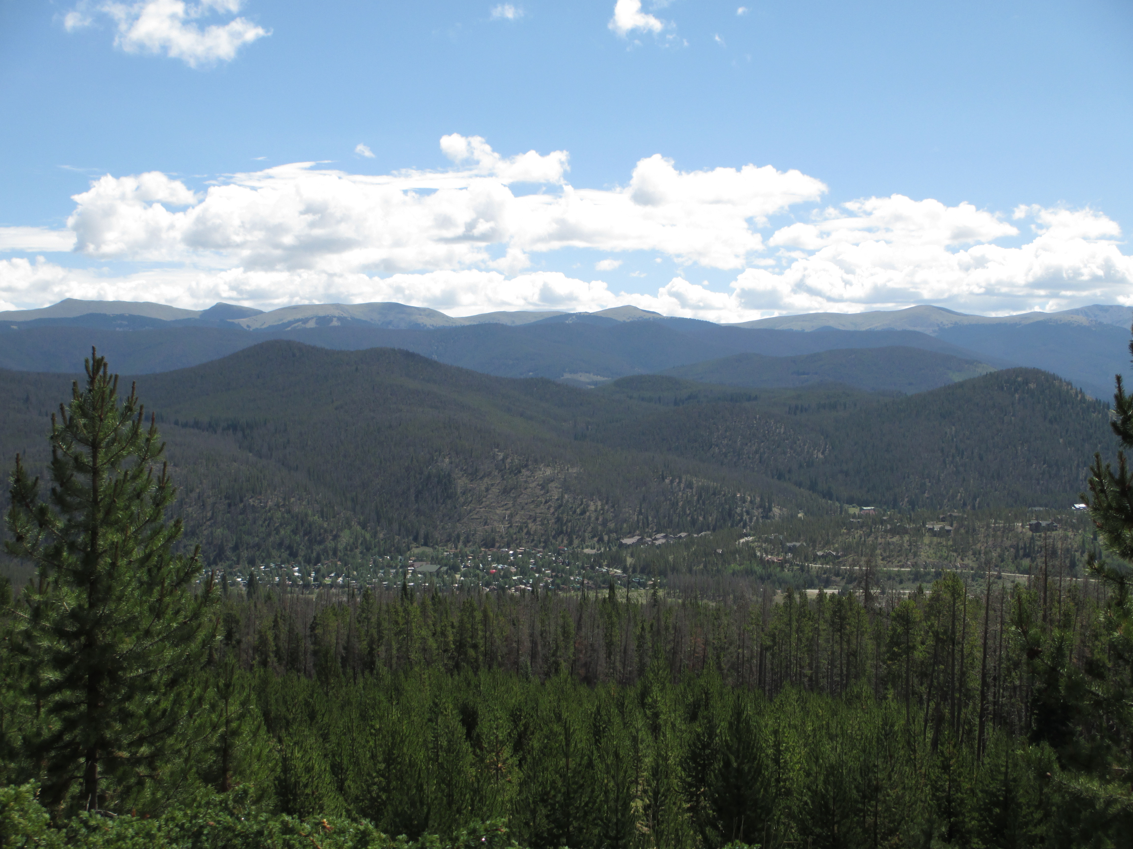
David faxed me the pages I needed, for which I was charged $1/page. (My saviour!) I re-packed everything and walked to the bus station. I decided that if the skies looked threatening, I could at least get six miles in. I was let out at Highway 9, just where I had crossed the road yesterday morning at 9:30 am- before walking a long way in the opposite direction of Breckenridge! Oh, well. I had to let that bad day go and open myself to a new start.
I began the climb (which always feels much better after having real food), and found a fork in the trail at mile 1. I took out my guidebook pages. They said nothing. A cyclist came up behind me and I asked him if the trail to the left was the CT. He told me there was a swing at the end of the path (not far away). He didn’t know who had put it there. “You’re almost at the top!” he called back as he sped away. I decided to check out the swing. (I don’t often take moments of pure relaxation). My mind contemplated how the person who was so mean to me and threatened never to talk to me again the night before my hike was the person offering to do the most for me a week later, and checking to see if I was alive and okay the most frequently. I found that to be so strange and confusing!

I continued on. The trail was steep and slow-going at times and I sometimes had to stop to catch my breath. And then, the trail started going down and down! I wasn’t sure I was on the right trail! I was certainly losing all of the altitude I had just worked so hard to gain! I passed some day hikers, who had no packs, as well as other people sitting down. In general, I felt strong and good, and was making good time. I sat down for a break at one point and looked at my sunburned wrist. It was bubbling! (I’m not used to such strong sun!)

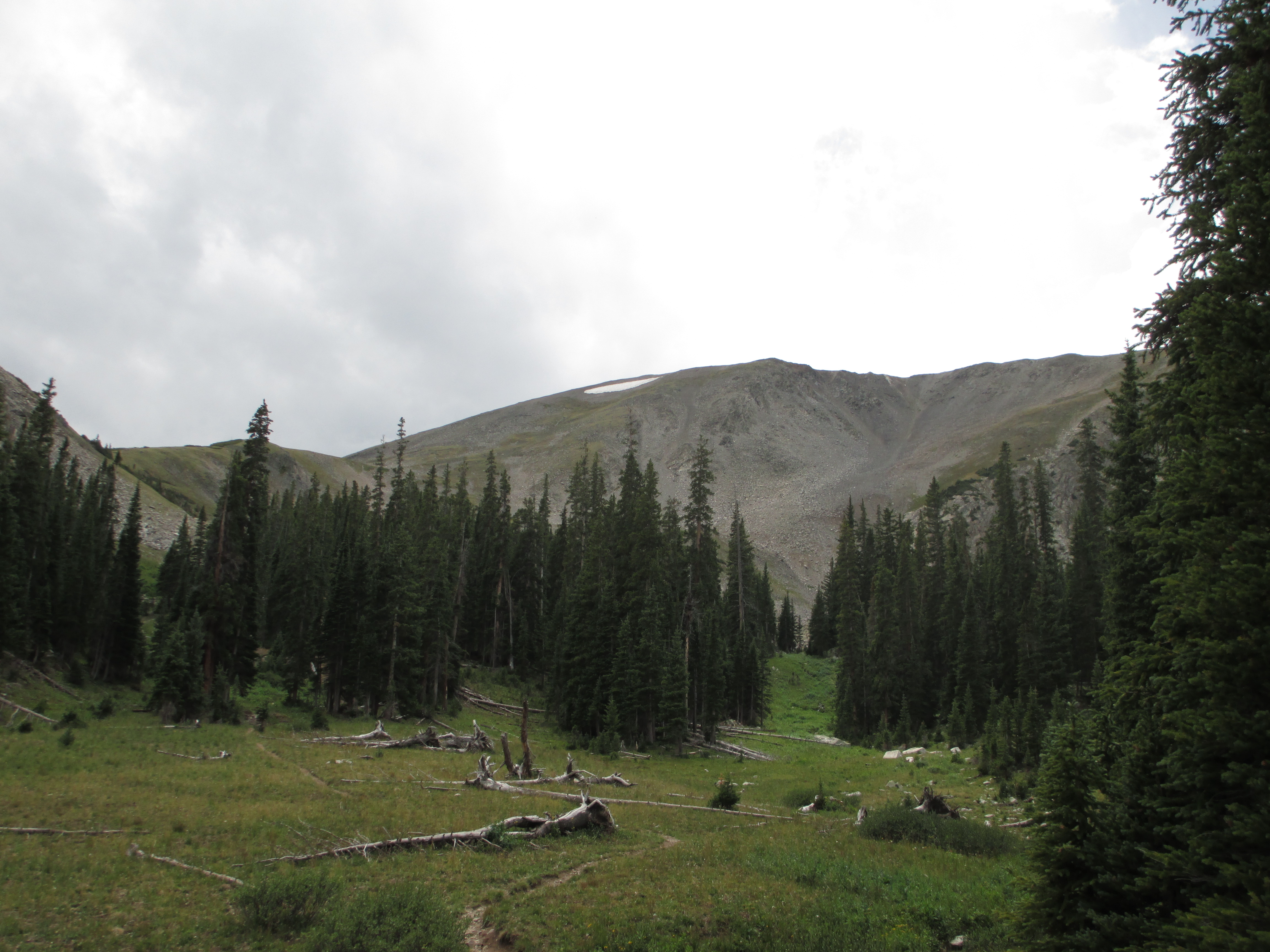
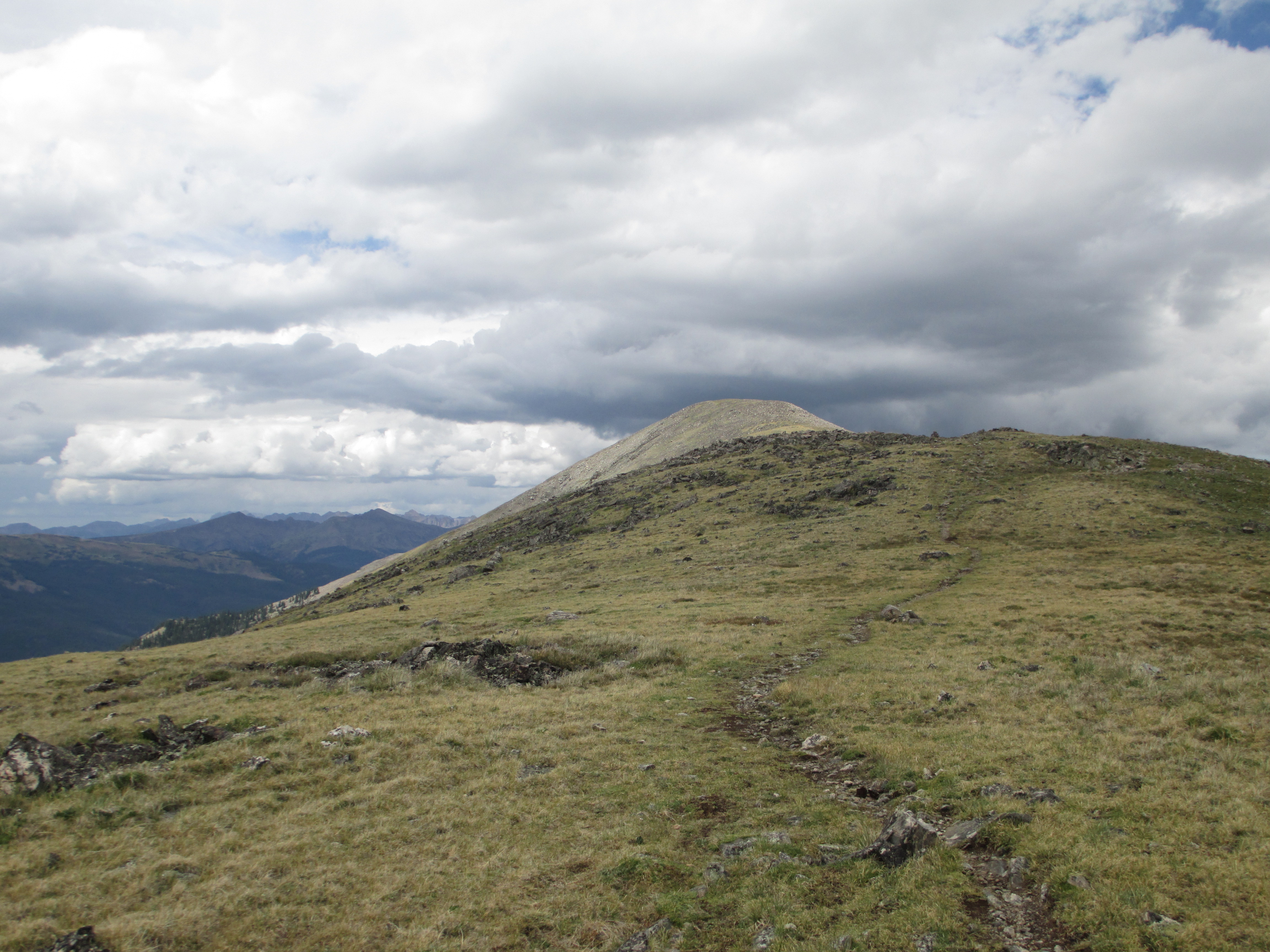
Soon, I reached mile 6, where I had to decide if I was going to camp and get up early to do the 4 miles of exposed terrain, or risk the storms. The climb was getting steeper and steeper, and I had to rest more often. It started to sprinkle already, but there were some puffy clouds and blue sky in parts of the sky. I passed an obnoxious group of kids on mountain bikes, and then two tents and a barking dog who obviously didn’t want me there. I was now creeping up to tree line and decided that I would risk the pass!
As soon as I stepped into the tundra, I heard the familiar sound of marmots (that I had seen and heard in Switzerland)! How happy that made me! I felt at home! And the views were stunning! Finally! I could see a huge lake below me and beautiful mountains all around me.


I started climbing again, stopped, breathed, and continued again. (The altitude made climbing harder than I have ever experienced it before!) I continuously checked the sky. There were always some puffy, white clouds, and some darker clouds in another area of the sky. I could see rain over Breckenridge and some distant mountains. It looked very dark- almost black. Behind me, the sky was gorgeous! I hoped the wind was moving the good weather in my direction, or at least that the rain would stop by the time I made it farther along.
It did not. It started sprinkling again, and then the rain got steadier. I kept eying the krumholz, deciding I would dive into this low vegetation if lightning struck. The trail continued to climb. It was tough work! I had to stop often. It felt like I was only moving one mile per hour!


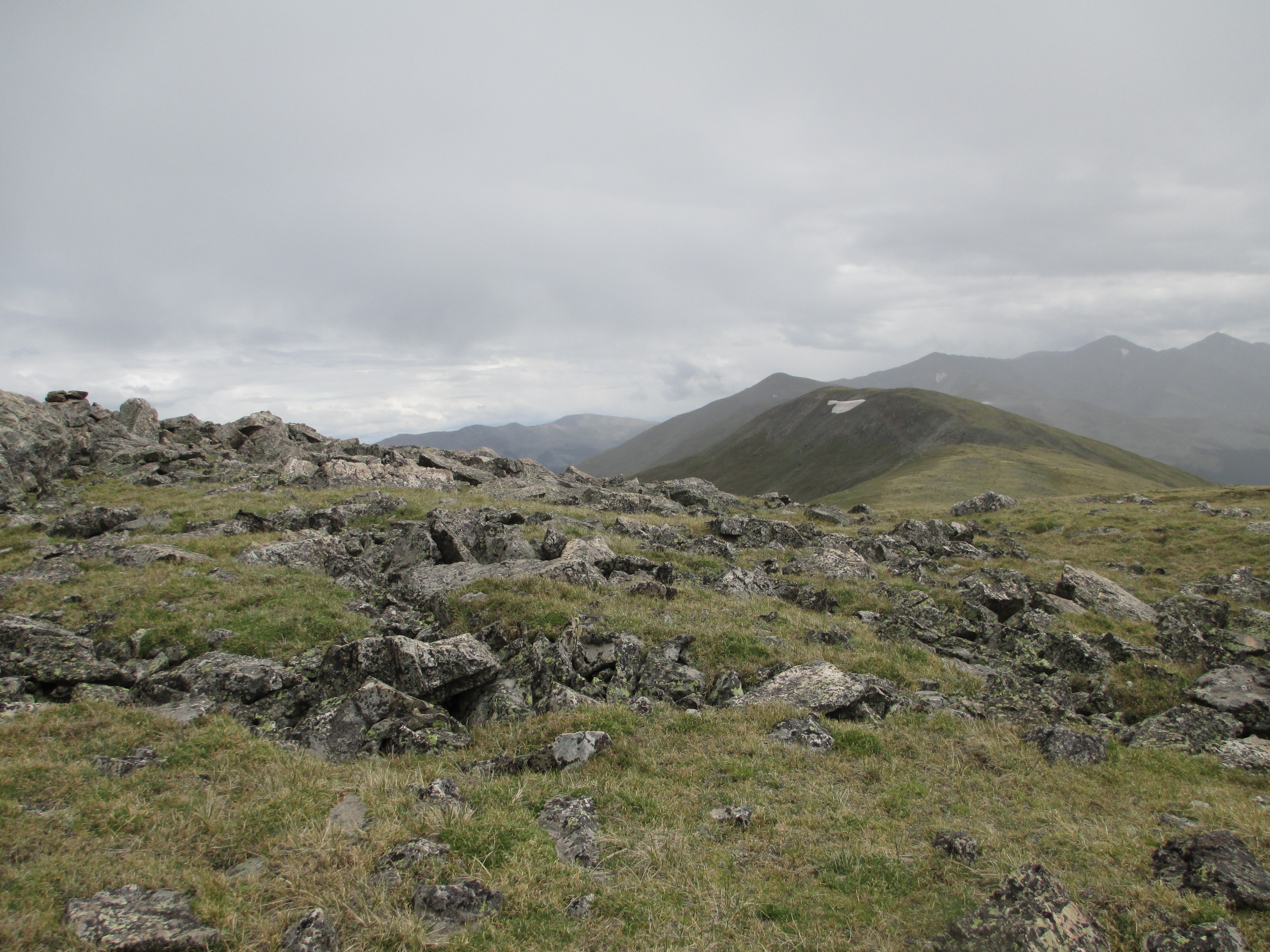
Finally, it started descending! And there was no lightning! I got lucky! Even though the views were obscured with the clouds, it was amazing to be in this exposed terrain. And it was just me out there! Just me, and the mountains, and the rain, and the birds, and the little pikas!

The skies darkened on the opposite side of the summit, so I decided to only sit down and eat a bite when I was closer to treeline.
The descent was steep and my knees were not happy. Finally, I was safely back among the trees!
I walked about 2 more miles and found a campsite just over the river and bridge. I heard sounds from the highway (0.4 miles away). I ate Thai noodles, a Hershey bar with almonds, and a power bar, and collected more water. It started to sprinkle again around 6:40, so I went inside my tent and journaled. The rain stopped about an hour later, so I went out to brush my teeth. The temperature had already dropped from 60 degrees to 50. It was 8:01 and I was ready for bed!
Tomorrow, I have a 13 mile climb!

